world.wikisort.org - USA
Leroy is a census-designated place located in Washington County, Alabama, around 60 miles (97 km) north of Mobile. As of the 2010 census, its population was 911.[4]
Leroy, Alabama | |
|---|---|
Census-designated place | |
 Location of Leroy in Washington County, Alabama. | |
 Leroy, Alabama Location of Leroy in Alabama | |
| Coordinates: 31°30′17″N 87°59′05″W | |
| Country | United States |
| State | Alabama |
| County | Washington |
| Area | |
| • Total | 11.98 sq mi (31.02 km2) |
| • Land | 11.91 sq mi (30.85 km2) |
| • Water | 0.07 sq mi (0.17 km2) |
| Elevation | 167 ft (51 m) |
| Population (2020) | |
| • Total | 766 |
| • Density | 64.32/sq mi (24.83/km2) |
| Time zone | UTC-6 (Central (CST)) |
| • Summer (DST) | UTC-5 (CDT) |
| ZIP code | 36548 |
| Area code(s) | 251 |
| FIPS code | 01-42304 |
| GNIS feature ID | 156602[2] |
| Other names | Dogwood Level New Canaan Possum Corner[2] |
| [3] | |
Demographics
| Historical population | |||
|---|---|---|---|
| Census | Pop. | %± | |
| 2020 | 766 | — | |
| U.S. Decennial Census[5] | |||
Notable people
- Sammie Coates, NFL wide receiver for the Kansas City Chiefs
- Phillip Ervin, professional baseball outfielder for the Cincinnati Reds
- Emanuel King, former NFL player
- Simmie Knox, American painter
- Kelvin Moore, former first baseman for the Oakland Athletics
- Danny Powell , Alabama baseball coaches Hall of Fame member
- Clifton Covington , Draft Pick of San Francisco Giants
- Clint Mosely , Auburn Quarterback
References
- "2020 U.S. Gazetteer Files". United States Census Bureau. Retrieved October 29, 2021.
- U.S. Geological Survey Geographic Names Information System: Leroy, Alabama. Retrieved on June 16, 2009.
- "Leroy AL". ZIP Code Lookup. Retrieved June 16, 2009.
- "U.S. Census website". United States Census Bureau. Retrieved May 14, 2011.
- "Census of Population and Housing". Census.gov. Retrieved June 4, 2016.
Municipalities and communities of Washington County, Alabama, United States | ||
|---|---|---|
County seat: Chatom | ||
| Towns | 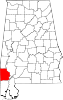 | |
| CDPs |
| |
| Unincorporated communities | ||
| Ghost towns |
| |
| Indian reservation |
| |
| Footnotes | ‡This populated place also has portions in an adjacent county or counties | |
| ||
This Washington County, Alabama state location article is a stub. You can help Wikipedia by expanding it. |
Текст в блоке "Читать" взят с сайта "Википедия" и доступен по лицензии Creative Commons Attribution-ShareAlike; в отдельных случаях могут действовать дополнительные условия.
Другой контент может иметь иную лицензию. Перед использованием материалов сайта WikiSort.org внимательно изучите правила лицензирования конкретных элементов наполнения сайта.
Другой контент может иметь иную лицензию. Перед использованием материалов сайта WikiSort.org внимательно изучите правила лицензирования конкретных элементов наполнения сайта.
2019-2026
WikiSort.org - проект по пересортировке и дополнению контента Википедии
WikiSort.org - проект по пересортировке и дополнению контента Википедии