world.wikisort.org - USA
Left Hand (also Justices, Knights, or Lefthand) is an unincorporated community in southeastern Roane County, West Virginia, United States. It lies along West Virginia Route 36 southeast of the city of Spencer, the county seat of Roane County.[2] Its post office [3] is still active.
Left Hand | |
|---|---|
Unincorporated community | |
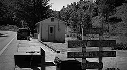
 Left Hand WV Post Office | |
 Left Hand Location within the state of West Virginia  Left Hand Left Hand (the United States) | |
| Coordinates: 38°37′7″N 81°14′42″W | |
| Country | United States |
| State | West Virginia |
| County | Roane |
| Elevation | 728 ft (222 m) |
| Population (2009) | |
| • Total | 390 |
| Time zone | UTC-5 (Eastern (EST)) |
| • Summer (DST) | UTC-4 (EDT) |
| ZIP codes | 25251 |
| GNIS feature ID | 1541751[1] |
The community was named after nearby Lefthand Run creek.[4][5]
Education
An elementary school "Geary Elementary/Middle School" is located in Left Hand, West Virginia.[6]
Gallery
References
- U.S. Geological Survey Geographic Names Information System: Left Hand, West Virginia
- DeLorme. West Virginia Atlas & Gazetteer. 4th ed. Yarmouth: DeLorme, 2007, p. 44. ISBN 0-89933-327-3.
- U.S. Geological Survey Geographic Names Information System: Left Hand, West Virginia
- Kenny, Hamill (1945). West Virginia Place Names: Their Origin and Meaning, Including the Nomenclature of the Streams and Mountains. Piedmont, WV: The Place Name Press. pp. 366–367.
- "Time and Custom Stand Still in the Hills and Hollers of West Virginia". Los Angeles Times. 10 February 1985.
- "Home". Archived from the original on 2010-02-04. Retrieved 2009-12-22.
Текст в блоке "Читать" взят с сайта "Википедия" и доступен по лицензии Creative Commons Attribution-ShareAlike; в отдельных случаях могут действовать дополнительные условия.
Другой контент может иметь иную лицензию. Перед использованием материалов сайта WikiSort.org внимательно изучите правила лицензирования конкретных элементов наполнения сайта.
Другой контент может иметь иную лицензию. Перед использованием материалов сайта WikiSort.org внимательно изучите правила лицензирования конкретных элементов наполнения сайта.
2019-2025
WikiSort.org - проект по пересортировке и дополнению контента Википедии
WikiSort.org - проект по пересортировке и дополнению контента Википедии

