world.wikisort.org - USA
Lee's Creek Township is one of thirty-seven townships in Washington County, Arkansas, USA.[2] As of the 2000 census, its total population was 640.
Township of Lee's Creek | |
|---|---|
Township | |
 Location of Lee's Creek Township in Washington County | |
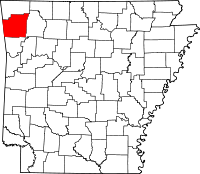 Location of Washington County in Arkansas | |
| Coordinates: 35°49′0″N 94°11′46″W | |
| Country | |
| State | |
| County | Washington |
| Established | 1880[1] |
| Area | |
| • Total | 33.1 sq mi (86 km2) |
| • Land | 33.1 sq mi (86 km2) |
| • Water | 0.0 sq mi (0 km2) 0% |
| Elevation | 1,621 ft (494 m) |
| Population (2000) | |
| • Total | 640 |
| • Density | 19/sq mi (7/km2) |
| Time zone | UTC-6 (CST) |
| • Summer (DST) | UTC-5 (CDT) |
| Area code | 479 |
| GNIS feature ID | 69793 |
| U.S. Geological Survey Geographic Names Information System: Lee's Creek Township, Washington County, Arkansas | |
Lee's Creek Township was established in 1880.[3]
Geography
According to the United States Census Bureau, Johnson Township covers an area of 33.1 square miles (86 km2), all land.[2] Devil's Den State Park makes up the southern tip of the township. The township was created from parts of Cove Creek Township and Crawford Township in 1880.[1]
Cities, towns, villages
Cemeteries
The township contains Blackburn Cemetery.
Major routes
 Interstate 540
 Arkansas Highway 74
 Arkansas Highway 170
References
- United States Census Bureau 2008 TIGER/Line Shapefiles
- United States Board on Geographic Names (GNIS)
- United States National Atlas
- Baker, Russell (1985). Arkansas Township Atlas 1819-1930. Hot Springs, AR: Arkansas Genealogical Society. p. 202. OCLC 11528205.
- "Township of Lee's Creek, Washington County, Arkansas". U.S. Census Bureau. Retrieved August 29, 2010.
- History of Benton, Washington, Carroll, Madison, Crawford, Franklin, and Sebastian Counties, Arkansas. Higginson Book Company. 1889. p. 167.
External links
Places adjacent to Lee's Creek Township, Washington County, Arkansas | ||||||||||||||||
|---|---|---|---|---|---|---|---|---|---|---|---|---|---|---|---|---|
| ||||||||||||||||
Municipalities and communities of Washington County, Arkansas, United States | ||
|---|---|---|
County seat: Fayetteville | ||
| Cities |  | |
| Town | ||
| Townships |
| |
| CDPs |
| |
| Other unincorporated communities |
| |
| Ghost towns |
| |
| Footnotes | ‡This populated place also has portions in an adjacent county or counties | |
| ||
Текст в блоке "Читать" взят с сайта "Википедия" и доступен по лицензии Creative Commons Attribution-ShareAlike; в отдельных случаях могут действовать дополнительные условия.
Другой контент может иметь иную лицензию. Перед использованием материалов сайта WikiSort.org внимательно изучите правила лицензирования конкретных элементов наполнения сайта.
Другой контент может иметь иную лицензию. Перед использованием материалов сайта WikiSort.org внимательно изучите правила лицензирования конкретных элементов наполнения сайта.
2019-2026
WikiSort.org - проект по пересортировке и дополнению контента Википедии
WikiSort.org - проект по пересортировке и дополнению контента Википедии