world.wikisort.org - USA
Clyde (historically Newtown) is an unincorporated community in Cane Hill Township, Washington County, Arkansas, United States.[1] Clyde is on Arkansas Highway 45, approximately 26 miles southwest of Fayetteville and six miles east of the Oklahoma border.
Clyde, Arkansas | |
|---|---|
Unincorporated community | |
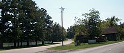
 Clyde at the intersection of AR 45 and Washington County Route 8. | |
 Clyde, Arkansas Clyde's position in Arkansas.  Clyde, Arkansas Clyde, Arkansas (the United States) | |
| Coordinates: 35°53′29″N 94°24′24″W[1] | |
| Country | |
| State | |
| County | Washington |
| Township | Cane Hill |
| Elevation | 403 m (1,322 ft) |
| Time zone | UTC-6 (Central (CST)) |
| • Summer (DST) | UTC-5 (CDT) |
| ZIP code | 72717 |
| Area code(s) | 479 |
| GNIS feature ID | 76643 [1] |
Within the Canehill, Arkansas ZIP code (72717), the population of the ZCTA was 847 at the 2000 census. It is part of the Fayetteville–Springdale–Rogers, AR-MO Metropolitan Statistical Area.
A post office was established at Clyde in 1879, and closed the next year.[2]
References
- "Clyde". Geographic Names Information System. United States Geological Survey. Retrieved 2010-09-15.
- History of Benton, Washington, Carroll, Madison, Crawford, Franklin, and Sebastian Counties, Arkansas. Higginson Book Company. 1889. p. 319.
Текст в блоке "Читать" взят с сайта "Википедия" и доступен по лицензии Creative Commons Attribution-ShareAlike; в отдельных случаях могут действовать дополнительные условия.
Другой контент может иметь иную лицензию. Перед использованием материалов сайта WikiSort.org внимательно изучите правила лицензирования конкретных элементов наполнения сайта.
Другой контент может иметь иную лицензию. Перед использованием материалов сайта WikiSort.org внимательно изучите правила лицензирования конкретных элементов наполнения сайта.
2019-2025
WikiSort.org - проект по пересортировке и дополнению контента Википедии
WikiSort.org - проект по пересортировке и дополнению контента Википедии
