world.wikisort.org - USA
Laurel is a city in Cedar County, Nebraska, United States. Its population was 964 at the 2010 census.[5]
This article uses bare URLs, which are uninformative and vulnerable to link rot. (August 2022) |
Laurel, Nebraska | |
|---|---|
City | |
 Downtown Laurel: 2nd Street east of Elm Street | |
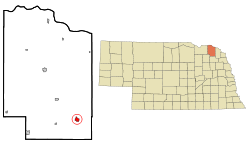 Location of Laurel, Nebraska | |
| Coordinates: 42°25′41″N 97°5′35″W | |
| Country | United States |
| State | Nebraska |
| County | Cedar |
| Government | |
| • Mayor | Keith Knudsen[1] |
| Area | |
| • Total | 1.35 sq mi (3.50 km2) |
| • Land | 1.35 sq mi (3.50 km2) |
| • Water | 0.00 sq mi (0.00 km2) |
| Elevation | 1,476 ft (450 m) |
| Population (2020) | |
| • Total | 972 |
| • Density | 718.40/sq mi (277.37/km2) |
| Time zone | UTC-6 (Central (CST)) |
| • Summer (DST) | UTC-5 (CDT) |
| ZIP code | 68745 |
| Area code | 402 |
| FIPS code | 31-26350[3] |
| GNIS feature ID | 0830637[4] |
| Website | Official City website |
History
Laurel was founded circa 1893.[6] It was originally named Claremont Junction. The present name is after Laura Martin, the daughter of one of the founders.[7]
In August 2022, 42-year old Jason A. Jones murdered four people and burned their houses.[citation needed]
Geography
Laurel is located at 42°25′41″N 97°5′35″W (42.427966, -97.093053).[8]
According to the United States Census Bureau, the city has a total area of 0.98 square miles (2.54 km2), all land.[9]
U.S. Route 20 and Nebraska Highway 15 serve the community.
Laurel is located in the Laurel-Concord-Coleridge School District.[10]
Demographics
| Historical population | |||
|---|---|---|---|
| Census | Pop. | %± | |
| 1900 | 514 | — | |
| 1910 | 514 | 0.0% | |
| 1920 | 830 | 61.5% | |
| 1930 | 864 | 4.1% | |
| 1940 | 861 | −0.3% | |
| 1950 | 944 | 9.6% | |
| 1960 | 922 | −2.3% | |
| 1970 | 1,009 | 9.4% | |
| 1980 | 1,031 | 2.2% | |
| 1990 | 981 | −4.8% | |
| 2000 | 986 | 0.5% | |
| 2010 | 964 | −2.2% | |
| 2020 | 972 | 0.8% | |
| U.S. Decennial Census[11] | |||
2010 census
At the 2010 census, 964 people in 415 households, including 263 families, lived in the city. The population density was 983.7 inhabitants per square mile (379.8/km2). The 474 housing units had an average density of 483.7 per square mile (186.8/km2). The racial makeup of the city was 96.8% White, 0.2% African American, 0.2% Native American, 0.3% Asian, 1.2% from other races, and 1.2% from two or more races. Hispanics or Latinos of any race were 2.4%.[12]
Of the 415 households, 26.3% had children under 18 living with them, 56.4% were married couples living together, 5.3% had a female householder with no husband present, 1.7% had a male householder with no wife present, and 36.6% were not families. About 33.5% of households were one person and 16.4% were one person aged 65 or older. The average household size was 2.26, and the average family size was 2.90.
The median age was 44.7 years; 22.6% of residents were under 18; 6.4% were between 18 and 24; 21.3% were from 25 to 44; 25% were from 45 to 64; and 24.7% were 65 or older. The gender makeup of the city was 48.0% male and 52.0% female.
2000 census
At the 2000 census, 986 people in 414 households, including 264 families, were in the city. The population density was 1,072.5 people per square mile (413.8/km2). The 466 housing units had an average density of 506.9 per square mile (195.6/km2). The racial makeup of the city was 99.49% White, 0.20% Native American, 0.10% Pacific Islander, 0.10% from other races, and 0.10% from two or more races. Hispanics or Latinos of any race were 0.30%.[3]
Of the 414 households, 26.3% had children under 18 living with them, 56.3% were married couples living together, 6.3% had a female householder with no husband present, and 36.0% were not families. About 32.9% of households were one person, and 22.9% were one person 65 or older. The average household size was 2.28, and the average family size was 2.91.
The age distribution was 23.3% under 18, 6.3% from 18 to 24, 20.4% from 25 to 44, 19.8% from 45 to 64, and 30.2% 65 or older. The median age was 45 years. For every 100 females, there were 85.0 males. For every 100 females 18 and over, there were 79.1 males.
The median household income was $29,722, and for a family was $35,662. Males had a median income of $26,731 versus $20,833 for females. The per capita income for the city was $16,500. About 6.0% of families and 8.4% of the population were below the poverty line, including 10.0% of those under age 18 and 7.2% of those age 65 or over.
Notable people
- James Coburn, actor
- Mark Calcavecchia, professional golfer
External links
References
- "Contact Us / Government".
- "ArcGIS REST Services Directory". United States Census Bureau. Retrieved September 18, 2022.
- "U.S. Census website". United States Census Bureau. Retrieved 2008-01-31.
- "US Board on Geographic Names". United States Geological Survey. 2007-10-25. Retrieved 2008-01-31.
- "Many Area Neb. Counties Lose Population".
- "Laurel, Cedar County". Center for Advanced Land Management Information Technologies. University of Nebraska. Retrieved 1 August 2014.
- Fitzpatrick, Lillian L. (1960). Nebraska Place-Names. University of Nebraska Press. p. 34. ISBN 0803250606.
- "US Gazetteer files: 2010, 2000, and 1990". United States Census Bureau. 2011-02-12. Retrieved 2011-04-23.
- "US Gazetteer files 2010". United States Census Bureau. Archived from the original on 2012-01-25. Retrieved 2012-06-24.
- http://www.lccschool.org/
- "Census of Population and Housing". Census.gov. Retrieved June 4, 2015.
- "U.S. Census website". United States Census Bureau. Retrieved 2012-06-24.
Municipalities and communities of Cedar County, Nebraska, United States | ||
|---|---|---|
County seat: Hartington | ||
| Cities |  | |
| Villages | ||
| CDPs | ||
| Unincorporated communities | ||
| ||
Другой контент может иметь иную лицензию. Перед использованием материалов сайта WikiSort.org внимательно изучите правила лицензирования конкретных элементов наполнения сайта.
WikiSort.org - проект по пересортировке и дополнению контента Википедии