world.wikisort.org - USA
Lake is a second-class township in Wayne County, Pennsylvania, United States. The township's population was 5,269 at the time of the 2010 United States Census.[7]
Lake, Pennsylvania | |
|---|---|
Second-class township | |
| Township of Lake | |
 Lake Ariel in the Village of Lake Ariel in the autumn. | |
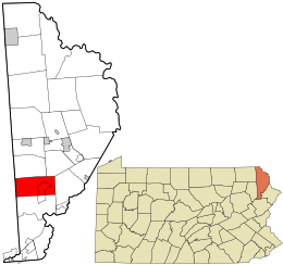 Location in Wayne County and the state of Pennsylvania. | |
| Country | United States |
| State | Pennsylvania |
| US Congressional District | PA-8 |
| State Senatorial District | 20 |
| State House of Representatives District | 111 |
| County | Wayne |
| School District | Western Wayne Region II |
| Incorporated | 1876[1] |
| Named for | Abundance of lakes in the area |
| Government | |
| • Type | Board of Supervisors |
| • Board of Supervisors[2] | Supervisors |
| • US Representative | Matt Cartwright (D) |
| • State Senator | Lisa Baker (R) |
| • State Representative | Jonathan Fritz (R) |
| Area | |
| • Total | 29.84 sq mi (77.29 km2) |
| • Land | 27.80 sq mi (71.99 km2) |
| • Water | 2.04 sq mi (5.30 km2) |
| Elevation | 1,470[4] ft (448 m) |
| Population (2010) | |
| • Total | 5,269 |
| • Estimate (2016)[5] | 5,082 |
| • Density | 182.83/sq mi (70.59/km2) |
| Time zone | UTC-5 (Eastern (EST)) |
| • Summer (DST) | UTC-4 (Eastern Daylight (EDT)) |
| Area code(s) | 570 |
| GNIS feature ID | 1217220[4] |
| FIPS code | 42-127-40936[6] |
Geography
According to the United States Census Bureau, the township has a total area of 29.8 square miles (77 km2), of which 27.8 square miles (72 km2) is land and 2.0 square miles (5.2 km2) (6.71%) is water.
Communities
The following villages are located in Lake Township:
 Village of Gravity

Demographics
| Historical population | |||
|---|---|---|---|
| Census | Pop. | %± | |
| 2010 | 5,269 | — | |
| 2016 (est.) | 5,082 | [5] | −3.5% |
| U.S. Decennial Census[15] | |||
As of the census of 2010, there were 5,269 people, 2,156 households, and 1,511 families residing in the township. The population density was 189.5 people per square mile (73.2/km2). There were 4,009 housing units at an average density of 144.2/sq mi (56.3/km2). The racial makeup of the township was 96% White, 1.6% African American, 0.2% Native American, 0.4% Asian, 0.7% from other races, and 1.1% from two or more races. Hispanic or Latino of any race were 2.9% of the population.
There were 2,156 households, out of which 21% had children under the age of 18 living with them, 58.7% were married couples living together, 7.9% had a female householder with no husband present, and 29.9% were non-families. 24.4% of all households were made up of individuals, and 10.6% had someone living alone who was 65 years of age or older. The average household size was 2.39 and the average family size was 2.83.
In the township the population was spread out, with 19% under the age of 18, 57.8% from 18 to 64, and 23.2% who were 65 years of age or older. The median age was 49 years.
The median income for a household in the township was $33,887, and the median income for a family was $37,821. Males had a median income of $29,609 versus $21,406 for females. The per capita income for the township was $16,274. About 8.7% of families and 10.5% of the population were below the poverty line, including 13.8% of those under age 18 and 12.8% of those age 65 or over.
References
- "Salem Township". Wayne County Historical Society. Wayne County Historical Society. 2014. Archived from the original on 19 December 2014. Retrieved 18 December 2014.
- "Municipal Index" (PDF). Wayne County Planning Commission/GIS. WordPress. 2011. Archived from the original (PDF) on 3 December 2014. Retrieved 22 November 2014.
- "2016 U.S. Gazetteer Files". United States Census Bureau. Retrieved Aug 14, 2017.
- "Township of Lake". Geographic Names Information System. United States Geological Survey, United States Department of the Interior. 1 December 1989. Retrieved 18 December 2014.
- "Population and Housing Unit Estimates". Retrieved June 9, 2017.
- U.S. Census Bureau. Census 2000. "Census Demographic Profiles, Lake Township" (PDF). CenStats Databases. Retrieved 18 December 2014.[dead link]
- "U.S. Census website". United States Census Bureau. Retrieved 2011-05-14.
- "LAKE: SECOND CLASS TOWNSHIP MAP" (PDF). Pennsylvania Department of Transportation. Commonwealth of Pennsylvania. 10 September 1993. Retrieved 18 December 2014.[permanent dead link]
- "Avoy". Geographic Names Information System. United States Geological Survey. 2 August 1979. Retrieved 18 December 2014.
- "Gravity". Geographic Names Information System. United States Geological Survey. 2 August 1979. Retrieved 18 December 2014.
- White, Israel Charles; Dolph, John M. (1881). The Geology of Susquehanna County and Wayne County (Report). Vol. 23. Board of Commissioners for the Second Geological Survey of Pennsylvania. p. 5. Retrieved 18 December 2014.
- "Maplewood". Geographic Names Information System. United States Geological Survey. 2 August 1979. Retrieved 18 December 2014.
- "Pink". Geographic Names Information System. United States Geological Survey. 2 August 1979. Retrieved 18 December 2014.
- "Tresslarville". Geographic Names Information System. United States Geological Survey. 2 August 1979. Retrieved 18 December 2014.
- "Census of Population and Housing". Census.gov. Retrieved June 4, 2016.
Municipalities and communities of Wayne County, Pennsylvania, United States | ||
|---|---|---|
County seat: Honesdale | ||
| Boroughs |  | |
| Townships | ||
| CDPs |
| |
| Other communities |
| |
| Footnotes | ‡This populated place also has portions in an adjacent county or counties | |
| ||
Другой контент может иметь иную лицензию. Перед использованием материалов сайта WikiSort.org внимательно изучите правила лицензирования конкретных элементов наполнения сайта.
WikiSort.org - проект по пересортировке и дополнению контента Википедии