world.wikisort.org - USA
Lake Poinsett is a census-designated place (CDP) in Hamlin and Brookings counties in South Dakota, United States. The population was 501 at the 2020 census.[5]
Lake Poinsett, South Dakota | |
|---|---|
Census-designated place | |
 Lake Poinsett | |
| Coordinates: 44°33′56″N 97°4′55″W | |
| Country | United States |
| State | South Dakota |
| Counties | Hamlin, Brookings |
| Area | |
| • Total | 17.77 sq mi (46.03 km2) |
| • Land | 4.89 sq mi (12.66 km2) |
| • Water | 12.88 sq mi (33.37 km2) |
| Elevation | 1,649 ft (503 m) |
| Population (2020)[2] | |
| • Total | 501 |
| • Density | 102.50/sq mi (39.57/km2) |
| Time zone | UTC-6 (Central (CST)) |
| • Summer (DST) | UTC-5 (CDT) |
| Area code | 605 |
| FIPS code | 46-35480[3] |
| GNIS feature ID | 1257162[4] |
Geography
The Lake Poinsett CDP comprises the lake of the same name and its shoreside communities in Hamlin and Brookings counties. U.S. Route 81 passes through the CDP along the western shore of the lake and leads north 24 miles (39 km) to Watertown and south 13 miles (21 km) to Arlington.
According to the United States Census Bureau, the Lake Poinsett CDP has a total area of 17.8 square miles (46.0 km2), of which 5.2 square miles (13.5 km2) is land and 12.5 square miles (32.5 km2), or 70.67%, is water.[6]
Demographics
| Historical population | |||
|---|---|---|---|
| Census | Pop. | %± | |
| 2020 | 501 | — | |
| U.S. Decennial Census[7] | |||
References
- "ArcGIS REST Services Directory". United States Census Bureau. Retrieved October 15, 2022.
- "Census Population API". United States Census Bureau. Retrieved Oct 15, 2022.
- "U.S. Census website". United States Census Bureau. Retrieved 2008-01-31.
- "US Board on Geographic Names". United States Geological Survey. 2007-10-25. Retrieved 2008-01-31.
- "U.S. Census Bureau: Lake Poinsett CDP, South Dakota". www.census.gov. United States Census Bureau. Retrieved 20 February 2022.
- "Geographic Identifiers: 2010 Demographic Profile Data (G001): Lake Poinsett CDP, South Dakota". U.S. Census Bureau, American Factfinder. Archived from the original on February 12, 2020. Retrieved April 7, 2014.
- "Census of Population and Housing". Census.gov. Retrieved June 4, 2016.
Municipalities and communities of Brookings County, South Dakota, United States | ||
|---|---|---|
County seat: Brookings | ||
| Cities |  | |
| Towns | ||
| CDPs |
| |
| Other communities |
| |
| Townships |
| |
| Footnotes | ‡This populated place also has portions in an adjacent county or counties | |
| ||
Municipalities and communities of Hamlin County, South Dakota, United States | ||
|---|---|---|
County seat: Hayti | ||
| Cities | 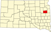 | |
| Towns | ||
| CDP |
| |
| Other communities |
| |
| Footnotes | ‡This populated place also has portions in an adjacent county or counties | |
| ||
Текст в блоке "Читать" взят с сайта "Википедия" и доступен по лицензии Creative Commons Attribution-ShareAlike; в отдельных случаях могут действовать дополнительные условия.
Другой контент может иметь иную лицензию. Перед использованием материалов сайта WikiSort.org внимательно изучите правила лицензирования конкретных элементов наполнения сайта.
Другой контент может иметь иную лицензию. Перед использованием материалов сайта WikiSort.org внимательно изучите правила лицензирования конкретных элементов наполнения сайта.
2019-2025
WikiSort.org - проект по пересортировке и дополнению контента Википедии
WikiSort.org - проект по пересортировке и дополнению контента Википедии