world.wikisort.org - USA
La Junta Gardens is a Census-designated place (CDP) in and governed by Otero County, Colorado, United States. The population of the La Junta Gardens CDP was 123 at the United States Census 2020.[1] The La Junta post office (Zip Code 81050) serves the area.[3]
La Junta Gardens, Colorado | |
|---|---|
Census-designated place | |
 Looking north along Jachim Avenue | |
 Location of the La Junta Gardens CDP in Otero County, Colorado. | |
 La Junta Gardens Location of the La Junta Gardens CDP in the United States. | |
| Coordinates: 38°00′05″N 103°33′17″W[1] | |
| Country | |
| State | |
| County | Otero County |
| Government | |
| • Type | unincorporated community |
| Area | |
| • Total | 0.533 sq mi (1.381 km2) |
| • Land | 0.533 sq mi (1.381 km2) |
| • Water | 0.000 sq mi (0.000 km2) |
| Elevation | 4,065 ft (1,239 m) |
| Population (2020)[1] | |
| • Total | 123 |
| • Density | 230/sq mi (89/km2) |
| Time zone | UTC-7 (MST) |
| • Summer (DST) | UTC-6 (MDT) |
| ZIP Code[3] | La Junta 81050 |
| Area codes | 970 |
| GNIS feature[2] | La Junta Gardens CDP |
Geography
The La Junta Gardens CDP has an area of 341 acres (1.381 km2), all land.[1]
Demographics
| Year | Pop. | ±% |
|---|---|---|
| 2010 | 153 | — |
| 2020 | 123 | −19.6% |
| Source: United States Census Bureau | ||
The United States Census Bureau initially defined the La Junta Gardens CDP for the United States Census 2010.
See also
- List of census-designated places in Colorado
References
- "State of Colorado Census Designated Places - BAS20 - Data as of January 1, 2020". United States Census Bureau. Retrieved December 26, 2020.
- "U.S. Board on Geographic Names: Domestic Names". United States Geological Survey. Retrieved December 26, 2020.
- "Zip Code 81050 Map and Profile". zipdatamaps.com. 2020. Retrieved December 26, 2020.
External links
Wikimedia Commons has media related to La Junta Gardens, Colorado.
- La Junta @ Colorado.com
- La Junta @ UncoverColorado.com
- La Junta Tourism
- La Junta Rural Fire Protection District
- Otero County website
Municipalities and communities of Otero County, Colorado, United States | ||
|---|---|---|
County seat: La Junta | ||
| Cities | 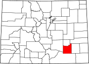 | |
| Towns | ||
| CDPs | ||
| Unincorporated communities |
| |
| Ghost town |
| |
| Footnotes | ‡This populated place also has portions in an adjacent county or counties | |
| ||
Текст в блоке "Читать" взят с сайта "Википедия" и доступен по лицензии Creative Commons Attribution-ShareAlike; в отдельных случаях могут действовать дополнительные условия.
Другой контент может иметь иную лицензию. Перед использованием материалов сайта WikiSort.org внимательно изучите правила лицензирования конкретных элементов наполнения сайта.
Другой контент может иметь иную лицензию. Перед использованием материалов сайта WikiSort.org внимательно изучите правила лицензирования конкретных элементов наполнения сайта.
2019-2026
WikiSort.org - проект по пересортировке и дополнению контента Википедии
WikiSort.org - проект по пересортировке и дополнению контента Википедии