world.wikisort.org - USA
Kingston Mines is a village in Peoria County, Illinois, United States. The population was 259 at the 2000 census. It is part of the Peoria, Illinois Metropolitan Statistical Area. Located on the Illinois River, it was a shipping port, loading coal from the nearby mines (the largest nearby mine was called, Kingston).[2]
Kingston Mines | |
|---|---|
Village | |
 Kingston Mines post office and city hall | |
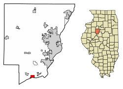 Location of Kingston Mines in Peoria County, Illinois. | |
 Location of Illinois in the United States | |
| Coordinates: 40°33′29″N 89°46′19″W | |
| Country | United States |
| State | Illinois |
| County | Peoria |
| Area | |
| • Total | 1.58 sq mi (4.11 km2) |
| • Land | 1.44 sq mi (3.74 km2) |
| • Water | 0.14 sq mi (0.37 km2) |
| Population (2020) | |
| • Total | 266 |
| • Density | 184.21/sq mi (71.11/km2) |
| Time zone | UTC-6 (CST) |
| • Summer (DST) | UTC-5 (CDT) |
| ZIP Code(s) | 61539 |
| Area code | 309 |
| FIPS code | 17-40091 |
| Wikimedia Commons | Kingston Mines, Illinois |
Geography
Kingston Mines is located at 40°33′29″N 89°46′19″W (40.558101, -89.771990).[3]
According to the 2010 census, Kingston Mines has a total area of 1.528 square miles (3.96 km2), of which 1.38 square miles (3.57 km2) (or 90.31%) is land and 0.148 square miles (0.38 km2) (or 9.69%) is water.[4]
Demographics
| Historical population | |||
|---|---|---|---|
| Census | Pop. | %± | |
| 1900 | 509 | — | |
| 1910 | 492 | −3.3% | |
| 1920 | 360 | −26.8% | |
| 1930 | 326 | −9.4% | |
| 1940 | 390 | 19.6% | |
| 1950 | 404 | 3.6% | |
| 1960 | 375 | −7.2% | |
| 1970 | 380 | 1.3% | |
| 1980 | 340 | −10.5% | |
| 1990 | 293 | −13.8% | |
| 2000 | 259 | −11.6% | |
| 2010 | 302 | 16.6% | |
| 2020 | 266 | −11.9% | |
| U.S. Decennial Census[5] | |||
As of the census[6] of 2000, there were 259 people, 98 households, and 68 families residing in the village. The population density was 193.2 inhabitants per square mile (74.6/km2). There were 105 housing units at an average density of 78.3 per square mile (30.2/km2). The racial makeup of the village was 95.75% White, 2.32% from other races, and 1.93% from two or more races. Hispanic or Latino of any race were 3.09% of the population.
There were 98 households, out of which 29.6% had children under the age of 18 living with them, 56.1% were married couples living together, 11.2% had a female householder with no husband present, and 29.6% were non-families. 26.5% of all households were made up of individuals, and 14.3% had someone living alone who was 65 years of age or older. The average household size was 2.64 and the average family size was 3.20.
In the village, the population was spread out, with 23.2% under the age of 18, 12.4% from 18 to 24, 27.4% from 25 to 44, 21.2% from 45 to 64, and 15.8% who were 65 years of age or older. The median age was 35 years. For every 100 females, there were 105.6 males. For every 100 females age 18 and over, there were 101.0 males.
The median income for a household in the village was $31,250, and the median income for a family was $45,556. Males had a median income of $26,000 versus $21,875 for females. The per capita income for the village was $14,908. About 2.9% of families and 5.2% of the population were below the poverty line, including 7.8% of those under the age of eighteen and none of those 65 or over.
References
- "2020 U.S. Gazetteer Files". United States Census Bureau. Retrieved March 15, 2022.
- Leyland, Marilyn J. (April 2021). "A History Underground". Peoria Magazine.
- "US Gazetteer files: 2010, 2000, and 1990". United States Census Bureau. 2011-02-12. Retrieved 2011-04-23.
- "G001 - Geographic Identifiers - 2010 Census Summary File 1". United States Census Bureau. Archived from the original on 2020-02-13. Retrieved 2015-08-04.
- "Census of Population and Housing". Census.gov. Retrieved June 4, 2015.
- "U.S. Census website". United States Census Bureau. Retrieved 2008-01-31.
Municipalities and communities of Peoria County, Illinois, United States | ||
|---|---|---|
County seat: Peoria | ||
| Cities |
|  |
| Villages | ||
| Townships | ||
| CDPs |
| |
| Other communities | ||
| Footnotes | ‡This populated place also has portions in an adjacent county or counties | |
| ||
Другой контент может иметь иную лицензию. Перед использованием материалов сайта WikiSort.org внимательно изучите правила лицензирования конкретных элементов наполнения сайта.
WikiSort.org - проект по пересортировке и дополнению контента Википедии