world.wikisort.org - USA
King is a census-designated place in Town of Farmington, Waupaca County, Wisconsin.[2] As of the 2010 census, it had a population of 1,750.[3] Before 2010, it was part of the Chain O' Lakes-King, Wisconsin CDP.[4]
King, Wisconsin | |
|---|---|
Census-designated place | |
 | |
 Location of King, Wisconsin | |
| Coordinates: 44°20′15″N 89°08′30″W | |
| Country | United States |
| State | Wisconsin |
| County | Waupaca |
| Area | |
| • Total | 2.326 sq mi (6.02 km2) |
| • Land | 2.158 sq mi (5.59 km2) |
| • Water | 0.168 sq mi (0.44 km2) |
| Population (2010) | |
| • Total | 1,750 |
| • Density | 750/sq mi (290/km2) |
| Time zone | UTC-6 (Central (CST)) |
| • Summer (DST) | UTC-5 (CDT) |
| FIPS code | 55-13885[1] |
| GNIS feature ID | 1567492 |
History
In 1887, the area was selected by the Grand Army of the Republic for the site of a veterans' home. The Soldiers' Home was later renamed the Wisconsin Veterans Home.[5] The community is named for General Charles King, a Wisconsin soldier and head of the state's National Guard.[6]
Images
 King water tower overlooking the Veterans Cottages Historic District
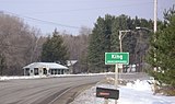 Highway sign for King along Wisconsin Highway 22
 King Fire Department
 Wisconsin Veterans Memorial Cemetery
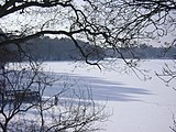 Rainbow Lake as seen from the Wisconsin Veterans Home
 Commandant's Residence Home


References
- "U.S. Census website". United States Census Bureau. Retrieved 2008-01-31.
- "King, Waupaca Co". www.wisconsinhistory.org. Archived from the original on 2011-06-11.
- "U.S. Census website". U.S. Census Bureau. Retrieved 26 March 2011.
- Bureau, US Census. "Site Maintenance" (PDF). censtats.census.gov. Archived from the original (PDF) on 2012-05-06. Retrieved 2016-04-11.
- Kim J. Heltemes. Wisconsin Veterans Home at King. Charleston, SC: Arcadia, 2004. ISBN 0-7385-3285-1
- "General Charles King Marker". www.hmdb.org. Retrieved 2016-04-11.
External links
Wikimedia Commons has media related to King, Waupaca County, Wisconsin.
Municipalities and communities of Waupaca County, Wisconsin, United States | ||
|---|---|---|
County seat: Waupaca | ||
| Cities |  | |
| Villages | ||
| Towns |
| |
| CDPs | ||
| Other communities |
| |
| Former communities | ||
| Footnotes | ‡This populated place also has portions in an adjacent county or counties | |
| ||
Authority control | |
|---|---|
| General |
|
| National libraries | |
This Wisconsin-related article is a stub. You can help Wikipedia by expanding it. |
This article about a location in Waupaca County, Wisconsin is a stub. You can help Wikipedia by expanding it. |
На других языках
[de] King (Wisconsin)
King ist eine Siedlung auf gemeindefreiem Gebiet im Waupaca County im US-amerikanischen Bundesstaat Wisconsin. Zu statistischen Zwecken ist der Ort zu einem Census-designated place (CDP) zusammengefasst worden. Im Jahr 2010 hatte King 1750 Einwohner.[1]- [en] King, Waupaca County, Wisconsin
Текст в блоке "Читать" взят с сайта "Википедия" и доступен по лицензии Creative Commons Attribution-ShareAlike; в отдельных случаях могут действовать дополнительные условия.
Другой контент может иметь иную лицензию. Перед использованием материалов сайта WikiSort.org внимательно изучите правила лицензирования конкретных элементов наполнения сайта.
Другой контент может иметь иную лицензию. Перед использованием материалов сайта WikiSort.org внимательно изучите правила лицензирования конкретных элементов наполнения сайта.
2019-2025
WikiSort.org - проект по пересортировке и дополнению контента Википедии
WikiSort.org - проект по пересортировке и дополнению контента Википедии