world.wikisort.org - USA
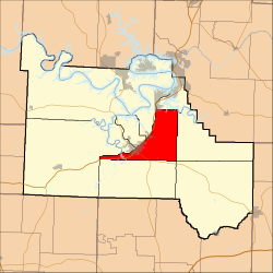
Kiheka Township is one of eleven townships in Camden County, Missouri, USA. As of the 2000 census, its population was 4,237.
Kiheka Township | |
|---|---|
Township | |
 | |
| Coordinates: 38°01′47″N 092°41′03″W | |
| Country | United States |
| State | Missouri |
| County | Camden |
| Area | |
| • Total | 42.12 sq mi (109.08 km2) |
| • Land | 41.61 sq mi (107.76 km2) |
| • Water | 0.51 sq mi (1.32 km2) 1.21% |
| Elevation | 728 ft (222 m) |
| Population (2000) | |
| • Total | 4,237 |
| • Density | 101.8/sq mi (39.3/km2) |
| FIPS code | 29-38585[2] |
| GNIS feature ID | 1729741 |
Geography
Kiheka Township covers an area of 42.12 square miles (109.1 km2) and contains no incorporated settlements. It contains six cemeteries: Caviness, Davis, Hugo, Percival Memorial, Williams and Zion.
The stream of Watered Hollow Branch runs through this township.
Transportation
Kiheka Township contains one airport or landing strip, Heritage Landing Strip.
References
- "US Board on Geographic Names". United States Geological Survey. 2007-10-25. Retrieved 2008-01-31.
- "U.S. Census website". United States Census Bureau. Retrieved 2008-01-31.
External links
Municipalities and communities of Camden County, Missouri, United States | ||
|---|---|---|
County seat: Camdenton | ||
| Cities |  | |
| Villages |
| |
| Townships | ||
| CDPs |
| |
| Other communities |
| |
| Footnotes | ‡This populated place also has portions in an adjacent county or counties | |
| ||
This Camden County, Missouri state location article is a stub. You can help Wikipedia by expanding it. |
Текст в блоке "Читать" взят с сайта "Википедия" и доступен по лицензии Creative Commons Attribution-ShareAlike; в отдельных случаях могут действовать дополнительные условия.
Другой контент может иметь иную лицензию. Перед использованием материалов сайта WikiSort.org внимательно изучите правила лицензирования конкретных элементов наполнения сайта.
Другой контент может иметь иную лицензию. Перед использованием материалов сайта WikiSort.org внимательно изучите правила лицензирования конкретных элементов наполнения сайта.
2019-2025
WikiSort.org - проект по пересортировке и дополнению контента Википедии
WikiSort.org - проект по пересортировке и дополнению контента Википедии