world.wikisort.org - USA
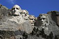
Keystone is a town in the Black Hills region of Pennington County, South Dakota, United States. The population was 240 at the 2020 census.[5] It had its origins in 1883 as a mining town, and has since transformed itself into a resort town, serving the needs of the millions of visitors to the Mount Rushmore National Memorial, which is located just beyond the town limits. Keystone was heavily damaged in the 1972 Black Hills flood.
Keystone, South Dakota | |
|---|---|
Town | |
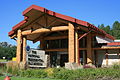
 Business district in Keystone (March 2012) | |
| Motto: "Home of Mount Rushmore" | |
 Location in Pennington County and the state of South Dakota | |
| Coordinates: 43°53′37″N 103°25′34″W | |
| Country | United States |
| State | South Dakota |
| County | Pennington |
| Area | |
| • Total | 3.00 sq mi (7.77 km2) |
| • Land | 3.00 sq mi (7.77 km2) |
| • Water | 0.00 sq mi (0.00 km2) |
| Elevation | 4,331 ft (1,320 m) |
| Population (2020)[2] | |
| • Total | 240 |
| • Density | 80.00/sq mi (30.89/km2) |
| Time zone | UTC-7 (Mountain (MST)) |
| • Summer (DST) | UTC-6 (MDT) |
| ZIP code | 57751 |
| Area code | 605 |
| FIPS code | 46-33820[3] |
| GNIS feature ID | 1261912[4] |
The town took its name from a local mine, which most likely was named after the keystone Masonic symbol.[6]
Geography
Keystone is located at 43°53′37″N 103°25′34″W.[7]
According to the United States Census Bureau, the town has a total area of 2.86 square miles (7.41 km2), all land.[8]
Keystone has been assigned the ZIP code 57751 and the FIPS place code 33820.
Demographics
| Historical population | |||
|---|---|---|---|
| Census | Pop. | %± | |
| 1980 | 295 | — | |
| 1990 | 232 | −21.4% | |
| 2000 | 311 | 34.1% | |
| 2010 | 337 | 8.4% | |
| 2020 | 240 | −28.8% | |
| U.S. Decennial Census[9][2] | |||
2010 census
At the 2010 census there were 337 people, 153 households, and 81 families living in the town. The population density was 117.8 inhabitants per square mile (45.5/km2). There were 230 housing units at an average density of 80.4 per square mile (31.0/km2). The racial makeup of the town was 93.8% White, 3.3% Native American, 0.6% Asian, 0.3% Pacific Islander, 0.3% from other races, and 1.8% from two or more races. Hispanic or Latino of any race were 8.3%.[10]
Of the 153 households 23.5% had children under the age of 18 living with them, 39.2% were married couples living together, 8.5% had a female householder with no husband present, 5.2% had a male householder with no wife present, and 47.1% were non-families. 34.0% of households were one person and 10.4% were one person aged 65 or older. The average household size was 2.20 and the average family size was 2.83.
The median age in the town was 42.8 years. 22.3% of residents were under the age of 18; 3.8% were between the ages of 18 and 24; 27.5% were from 25 to 44; 33.5% were from 45 to 64; and 12.8% were 65 or older. The gender makeup of the town was 50.7% male and 49.3% female.
2000 census
At the 2000 census there were 311 people, 152 households, and 84 families living in the town. The population density was 108.6 people per square mile (42.0/km2). There were 209 housing units at an average density of 73.0 per square mile (28.2/km2). The racial makeup of the town was 95.50% White, 1.93% Native American, 0.32% from other races, and 2.25% from two or more races. Hispanic or Latino of any race were 3.54%.[3]
Of the 152 households 27.0% had children under the age of 18 living with them, 37.5% were married couples living together, 12.5% had a female householder with no husband present, and 44.1% were non-families. 35.5% of households were one person and 11.8% were one person aged 65 or older. The average household size was 2.05 and the average family size was 2.60.
The age distribution was 20.9% under the age of 18, 5.8% from 18 to 24, 30.9% from 25 to 44, 30.9% from 45 to 64, and 11.6% 65 or older. The median age was 41 years. For every 100 females, there were 89.6 males. For every 100 females age 18 and over, there were 95.2 males.
The median household income was $26,406, and the median family income was $36,250. Males had a median income of $24,219 versus $17,500 for females. The per capita income for the town was $15,828. About 13.9% of families and 16.9% of the population were below the poverty line, including 17.9% of those under age 18 and 23.3% of those age 65 or over.
Arts and culture
Among its tourist attractions is the Black Hills Central Railroad, built in 1900 for Black Hills gold. It now operates passenger trains pulled by preserved steam locomotives.
Another prominent local attraction is The National Presidential Wax Museum, which features wax sculptures of every president in U.S. history and several notable Sioux Chiefs, inventors, and international political figures. The wax figures are the work of world-renowned wax sculptor Katherine Stubergh whose notable works include wax figures used in Gone With the Wind and the 1953 film House of Wax.
Carrie Ingalls (sister of Little House on the Prairie author Laura Ingalls Wilder) spent a significant part of her adult life there, living with her husband David N. Swanzey and his children. Her sister Mary Ingalls lived with them as an adult. Both Carrie and Mary died in Keystone, but were buried in the family plot in De Smet.
Bobby Buntrock, who played Harold on the TV series Hazel, is buried in Keystone.
This town was one of the filming locations for the Columbia Pictures 1994 comedy film North.
In popular culture
This section is empty. You can help by adding to it. (August 2020) |
Photo gallery
 The National Presidential Wax Museum, a private museum in Keystone
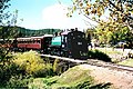 Black Hills Central Railroad
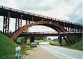 Keystone Wye just north of the town
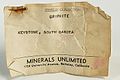 Identification card of griphite mineral
 Crystals at the Etta Mine
 Keystone schools from 1895 and 1899, now a museum


References
- "ArcGIS REST Services Directory". United States Census Bureau. Retrieved October 15, 2022.
- "Census Population API". United States Census Bureau. Retrieved Oct 15, 2022.
- "U.S. Census website". United States Census Bureau. Retrieved 2008-01-31.
- "US Board on Geographic Names". United States Geological Survey. 2007-10-25. Retrieved 2008-01-31.
- "U.S. Census Bureau: Keystone town, South Dakota". www.census.gov. United States Census Bureau. Retrieved 19 March 2022.
- Federal Writers' Project (1940). South Dakota place-names, v.1-3. University of South Dakota. p. 45.
- "US Gazetteer files: 2010, 2000, and 1990". United States Census Bureau. 2011-02-12. Retrieved 2011-04-23.
- "US Gazetteer files 2010". United States Census Bureau. Archived from the original on 2012-01-25. Retrieved 2012-06-21.
- "Census of Population and Housing". Census.gov. Retrieved June 4, 2015.
- "U.S. Census website". United States Census Bureau. Retrieved 2012-06-21.
External links
Municipalities and communities of Pennington County, South Dakota, United States | ||
|---|---|---|
County seat: Rapid City | ||
| Cities |  | |
| Towns | ||
| CDPs | ||
| Former CDP | ||
| Other communities |
| |
| Ghost towns |
| |
| Footnotes | ‡This populated place also has portions in an adjacent county or counties | |
| ||
Authority control | |
|---|---|
| General | |
| National libraries | |
| Other | |
На других языках
[de] Keystone (South Dakota)
Keystone ist eine Town in den Black Hills im Pennington County im US-Bundesstaat South Dakota. Im Jahr 2010 hatte der Ort 337 Einwohner. Keystone entstand 1883 als Bergbausiedlung, ist in der Gegenwart jedoch ein touristisches Ziel, vor allem wegen des gerade außerhalb der Stadtgrenzen liegenden Mount Rushmore National Memorial. Zu den Sehenswürdigkeiten gehört die 1900 zum Abbau von Gold gebaute Black Hills Central Railroad, die nunmehr mit instandgehaltenen Dampflokomotiven Touristenzüge befahren.- [en] Keystone, South Dakota
Другой контент может иметь иную лицензию. Перед использованием материалов сайта WikiSort.org внимательно изучите правила лицензирования конкретных элементов наполнения сайта.
WikiSort.org - проект по пересортировке и дополнению контента Википедии