world.wikisort.org - USA
Kent Township is one of twelve townships in Warren County, Indiana, United States. According to the 2010 census, its population was 428 and it contained 196 housing units.[2]
Kent Township | |
|---|---|
Township | |
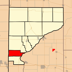 Location of Kent Township in Warren County | |
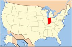 Location of Indiana in the United States | |
| Coordinates: 40°11′44″N 87°28′32″W | |
| Country | United States |
| State | Indiana |
| County | Warren |
| Government | |
| • Type | Indiana township |
| Area | |
| • Total | 14.11 sq mi (36.5 km2) |
| • Land | 14 sq mi (40 km2) |
| • Water | 0.11 sq mi (0.3 km2) 0.78% |
| Elevation | 692 ft (211 m) |
| Population (2010) | |
| • Total | 428 |
| • Density | 30.6/sq mi (11.8/km2) |
| Time zone | UTC-5 (Eastern (EST)) |
| • Summer (DST) | UTC-4 (EDT) |
| ZIP Code | 47993 |
| Area code(s) | 765 |
| GNIS feature ID | 453524 |
History
Kent Township was created in September 1864 from a section of Mound Township.[3]
Geography
According to the 2010 census, the township has a total area of 14.11 square miles (36.5 km2), of which 14 square miles (36 km2) (or 99.22%) is land and 0.11 square miles (0.28 km2) (or 0.78%) is water.[2] It contains one town, State Line City, which is in the far western part of the township next to the Indiana / Illinois border.

Cemeteries
The township contains Gopher Hill Cemetery[4] and Masonic Cemetery.[5]
Transportation
Both Indiana State Road 63 and Indiana State Road 263 pass through the eastern part of the township from north to south.[6][7]
A Norfolk Southern Railway line enters the township from Danville, Illinois and passes through State Line City, continuing northeast toward the county seat of Williamsport.[8]
Education
Kent Township is part of the Metropolitan School District of Warren County.[9]
Government
Kent Township has a trustee who administers rural fire protection and ambulance service, provides poor relief, manages cemetery care, and performs farm assessment, among other duties. The trustee is assisted in these duties by a three-member township board. The trustees and board members are elected to four-year terms.[10]
Kent Township is part of Indiana's 8th congressional district, Indiana House of Representatives District 42,[11] and Indiana State Senate District 38.[12]
References
- "US Board on Geographic Names". United States Geological Survey. October 25, 2007. Retrieved 2017-05-09.
- "Population, Housing Units, Area, and Density: 2010 - County -- County Subdivision and Place -- 2010 Census Summary File 1". United States Census. Archived from the original on 2020-02-12. Retrieved 2013-05-10.
- Warren County Historical Society 1966, p. 28.
- "Gopher Hill Cemetery". Geographic Names Information System. United States Geological Survey. Retrieved 2011-01-27.
- "Masonic Cemetery". Geographic Names Information System. United States Geological Survey. Retrieved 2011-01-27.
- "State Road 63". Highway Explorer. Archived from the original on 2012-03-09. Retrieved 2010-09-21.
- "State Road 263". Highway Explorer. Archived from the original on 2012-04-06. Retrieved 2010-09-21.
- "State of Indiana 2012 Rail System Map" (PDF). Indiana Department of Transportation. 2012. Retrieved 2013-12-02.
- "Corporation Snapshot, M S D Warren County #8115". Indiana Department of Education. Archived from the original on 2002-07-06. Retrieved 2011-01-27.
- "Government". United Township Association of Indiana. Retrieved 2011-01-06.
- "Indiana Senate" (PDF). State of Indiana. Retrieved 2013-12-02.
- "Indiana House Districts" (PDF). State of Indiana. Retrieved 2013-12-02.
- "Kent Township, Warren County, Indiana". Geographic Names Information System. United States Geological Survey. Retrieved 2009-09-24.
- United States Census Bureau TIGER/Line Shapefiles
Bibliography
- Goodspeed, Weston A. (1883). "Part II. History of Warren County". Counties of Warren, Benton, Jasper and Newton, Indiana. Chicago: F. A. Battey and Company. pp. 31–156. Retrieved 2010-09-19.
- Clifton, Thomas, ed. (1913). Past and Present of Fountain and Warren Counties Indiana. Indianapolis: B. F. Bowen and Company. pp. 201–335. Retrieved 2010-09-19.
- Warren County Historical Society (1966). A History of Warren County, Indiana. Williamsport, Indiana.
- Warren County Historical Society (2002). A History of Warren County, Indiana (175th Anniversary Edition). Williamsport, Indiana.
External links
Places adjacent to Kent Township, Warren County, Indiana | ||||||||||||||||
|---|---|---|---|---|---|---|---|---|---|---|---|---|---|---|---|---|
| ||||||||||||||||
Municipalities and communities of Warren County, Indiana, United States | ||
|---|---|---|
County seat: Williamsport | ||
| Towns |
|  |
| Townships | ||
| CDPs |
| |
| Other communities |
| |
| Ghost towns |
| |
| Footnotes | ‡This populated place also has portions in an adjacent county or counties | |
| ||
Другой контент может иметь иную лицензию. Перед использованием материалов сайта WikiSort.org внимательно изучите правила лицензирования конкретных элементов наполнения сайта.
WikiSort.org - проект по пересортировке и дополнению контента Википедии