world.wikisort.org - USA
Kent is an unincorporated community in Sherman County, Oregon, United States.[1] Kent has a post office with a ZIP code 97033.[2] Kent lies at the intersection of U.S. Route 97 and Dobie Point Road, between Grass Valley to the north and Shaniko to the south.[3]
Kent, Oregon | |
|---|---|
Unincorporated community | |
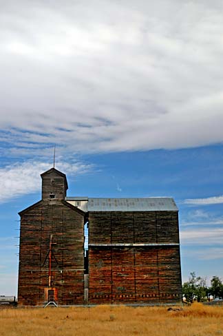 Old grain elevator in Kent | |
 Kent, Oregon  Kent, Oregon | |
| Coordinates: 45°11′42″N 120°41′39″W | |
| Country | United States |
| State | Oregon |
| County | Sherman |
| Elevation | 2,713 ft (827 m) |
| Time zone | UTC-8 (Pacific (PST)) |
| • Summer (DST) | UTC-7 (PDT) |
| ZIP code | 97033 |
| Area code(s) | 458 and 541 |
| GNIS feature ID | 1122693[1] |
Kent was the site of a railway station, originally called Guthrie, on the Columbia Southern Railway. The name of the community stemmed from a drawing from a group of names submitted by local residents that was drawn out of a hat by Kent's first postmaster, according to the original residents. Milton H. Bennett was that postmaster, who ran the post office beginning in about 1887. The name was suggested because it was short and easy to write.[4]
Climate
This region experiences warm (but not hot) and dry summers, with no average monthly temperatures above 68.1 °F (20.1 °C). According to the Köppen Climate Classification system, Kent has a steppe climate, abbreviated "BSk" on climate maps.
| Climate data for Kent, Oregon | |||||||||||||
|---|---|---|---|---|---|---|---|---|---|---|---|---|---|
| Month | Jan | Feb | Mar | Apr | May | Jun | Jul | Aug | Sep | Oct | Nov | Dec | Year |
| Record high °F (°C) | 63 (17) |
69 (21) |
77 (25) |
89 (32) |
97 (36) |
103 (39) |
107 (42) |
108 (42) |
102 (39) |
92 (33) |
77 (25) |
65 (18) |
108 (42) |
| Average high °F (°C) | 37.5 (3.1) |
42.9 (6.1) |
50.5 (10.3) |
57.8 (14.3) |
66.5 (19.2) |
74.2 (23.4) |
83.8 (28.8) |
83 (28) |
74.3 (23.5) |
62.4 (16.9) |
47.2 (8.4) |
39.5 (4.2) |
60 (16) |
| Average low °F (°C) | 22.9 (−5.1) |
26.7 (−2.9) |
30.5 (−0.8) |
34.1 (1.2) |
40 (4) |
46.2 (7.9) |
52.2 (11.2) |
52 (11) |
45.9 (7.7) |
38 (3) |
30 (−1) |
25.3 (−3.7) |
37 (3) |
| Record low °F (°C) | −17 (−27) |
−19 (−28) |
5 (−15) |
14 (−10) |
21 (−6) |
26 (−3) |
32 (0) |
36 (2) |
21 (−6) |
9 (−13) |
−10 (−23) |
−18 (−28) |
−19 (−28) |
| Average precipitation inches (mm) | 1.4 (36) |
1.08 (27) |
1 (25) |
0.93 (24) |
1.02 (26) |
0.87 (22) |
0.35 (8.9) |
0.38 (9.7) |
0.57 (14) |
0.87 (22) |
1.47 (37) |
1.48 (38) |
11.42 (290) |
| Average snowfall inches (cm) | 7 (18) |
3.9 (9.9) |
2.1 (5.3) |
0.7 (1.8) |
0 (0) |
0 (0) |
0 (0) |
0 (0) |
0.1 (0.25) |
0.2 (0.51) |
2.2 (5.6) |
5.2 (13) |
21.3 (54) |
| Average precipitation days | 10 | 9 | 9 | 8 | 7 | 6 | 2 | 3 | 4 | 7 | 10 | 9 | 84 |
| Source: [5] | |||||||||||||
See also
- Jack Knife Fire
References
- "Kent". Geographic Names Information System. United States Geological Survey. November 28, 1980. Retrieved November 2, 2016.
- "Search Results for Kent, Oregon". CD Light. 2016. Retrieved November 2, 2016.
- Oregon Atlas & Gazetteer (7th ed.). Yarmouth, Maine: DeLorme. 2008. p. 72. ISBN 978-0-89933-347-2.
- McArthur, Lewis A.; McArthur, Lewis L. (2003) [1928]. Oregon Geographic Names (7th ed.). Portland, Oregon: Oregon Historical Society Press. p. 530. ISBN 978-0875952772.
- "Kent, OR (354411)". Western Regional Climate Center. Retrieved November 26, 2015.
Municipalities and communities of Sherman County, Oregon, United States | ||
|---|---|---|
County seat: Moro | ||
| Cities |  | |
| CDP | ||
| Other communities | ||
| Indian reservation |
| |
| Footnotes | ‡This populated place also has portions in an adjacent county or counties | |
| ||
This Sherman County, Oregon state location article is a stub. You can help Wikipedia by expanding it. |
На других языках
- [en] Kent, Oregon
[ru] Кент (Орегон)
Кент (англ. Kent) — невключённая территория, расположенная в округе Шерман штата Орегон, США[1]. Хотя Кент является невключённой территорией, у него есть почтовое отделение с почтовым индексом 97033[2]. Расположен на пересечении автомагистрали U.S. 97 и Доби-Пойнт-Роад, между Грасс-Велли на севере и Шанико на юге[3].Другой контент может иметь иную лицензию. Перед использованием материалов сайта WikiSort.org внимательно изучите правила лицензирования конкретных элементов наполнения сайта.
WikiSort.org - проект по пересортировке и дополнению контента Википедии