world.wikisort.org - USA
Johnson Village is an unincorporated community and a census-designated place (CDP) located in and governed by Chaffee County, Colorado, United States. The population of the Johnson Village CDP was 246 at the United States Census 2010.[4] The Buena Vista post office (Zip Code 81211) serves the area.[3]
Johnson Village, Colorado | |
|---|---|
Census Designated Place | |
 View of Johnson Village with Mount Princeton in the background. | |
 Location of the Johnson Village CDP in Chaffee County, Colorado. | |
 Johnson Village Location of the Johnson Village CDP in the United States. | |
| Coordinates: 38°48′43″N 106°06′26″W[1] | |
| Country | |
| State | |
| County | Chaffee County |
| Government | |
| • Type | unincorporated community |
| Area | |
| • Total | 0.299 sq mi (0.774 km2) |
| • Land | 0.299 sq mi (0.774 km2) |
| • Water | 0.000 sq mi (0.000 km2) |
| Elevation | 7,854 ft (2,394 m) |
| Population (2010) | |
| • Total | 246 |
| • Density | 823/sq mi (318/km2) |
| Time zone | UTC-7 (MST) |
| • Summer (DST) | UTC-6 (MDT) |
| ZIP Code[3] | Buena Vista 81211 |
| Area code | 719 |
| GNIS feature[2] | Johnson Village CDP |
Geography
Johnson Village is located along the west side of the Arkansas River, where the river is bridged by U.S. Highway 24. It is approximately three miles south of the town of Buena Vista. The community consists largely of a strip of retail establishments along either side of U.S. Highway 24, on the west side of Trout Creek Pass. The economy of the town is based largely on pass-through traffic, including tourism, in particular whitewater rafting on the Arkansas River.
The Johnson Village CDP has an area of 191 acres (0.774 km2), all land.[1]
Demographics
The United States Census Bureau initially defined the Johnson Village CDP for the United States Census 2010.
| Year | Pop. | ±% |
|---|---|---|
| 2010 | 246 | — |
| 2020 | — | |
| Source: United States Census Bureau | ||
See also
- Outline of Colorado
- Index of Colorado-related articles
- State of Colorado
- Colorado cities and towns
- Colorado census designated places
- Colorado counties
- Chaffee County, Colorado
- Colorado cities and towns
- Arkansas Headwaters Recreation Area
- Browns Canyon National Monument
- Cottonwood Pass
- Trout Creek Pass
References
- "State of Colorado Census Designated Places - BAS20 - Data as of January 1, 2020". United States Census Bureau. Retrieved December 21, 2020.
- "U.S. Board on Geographic Names: Domestic Names". United States Geological Survey. Retrieved December 21, 2020.
- "Zip Code 81211 Map and Profile". zipdatamaps.com. 2020. Retrieved December 21, 2020.
- "2010: DEC Summary File 1". United States Census Bureau. Retrieved December 20, 2020.
External links
 Definitions from Wiktionary
 Media from Commons
 News from Wikinews
 Quotations from Wikiquote
 Texts from Wikisource
 Textbooks from Wikibooks
 Resources from Wikiversity
Municipalities and communities of Chaffee County, Colorado, United States | ||
|---|---|---|
County seat: Salida | ||
| City | 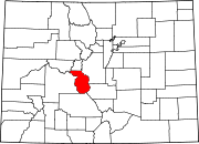 | |
| Towns | ||
| CDPs | ||
| Unincorporated communities | ||
| ||
Другой контент может иметь иную лицензию. Перед использованием материалов сайта WikiSort.org внимательно изучите правила лицензирования конкретных элементов наполнения сайта.
WikiSort.org - проект по пересортировке и дополнению контента Википедии