world.wikisort.org - USA
Joes is a census-designated place (CDP) and post office in and governed by Yuma County, Colorado, United States. The Joes post office has the ZIP Code 80822.[3] At the United States Census 2010, the population of the Joes CDP was 80, while the population of the 80822 ZIP Code Tabulation Area was 260 including adjacent areas.[4]
Joes, Colorado | |
|---|---|
Census-designated place | |
 Joes, looking east on U.S. Route 36. | |
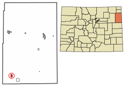 Location of the Joes CDP in Yuma County, Colorado. | |
 Joes Location of the Joes CDP in the United States. | |
| Coordinates: 39°39′21″N 102°40′43″W[1] | |
| Country | |
| State | |
| County | Yuma County |
| Government | |
| • Type | unincorporated town |
| Area | |
| • Total | 2.088 sq mi (5.408 km2) |
| • Land | 2.085 sq mi (5.401 km2) |
| • Water | 0.003 sq mi (0.007 km2) |
| Elevation | 4,275 ft (1,303 m) |
| Population (2010) | |
| • Total | 80 |
| • Density | 38/sq mi (15/km2) |
| Time zone | UTC-7 (MST) |
| • Summer (DST) | UTC-6 (MDT) |
| ZIP Code[3] | 80822 |
| Area code | 970 |
| GNIS feature[2] | Joes CDP |
History
The Joes post office has been in operation since 1912.[5] The community was named for the fact a share of the first settlers were named Joe.[6]
Geography
The Joes CDP has an area of 1,336 acres (5.408 km2), including 1.7 acres (0.007 km2) of water.[1] Joes is home to Liberty High School.
Demographics
| Year | Pop. | ±% |
|---|---|---|
| 2010 | 80 | — |
| 2020 | 92 | +15.0% |
| Source: United States Census Bureau | ||
The United States Census Bureau initially defined the Joes CDP for the United States Census 2010.
See also
- List of census-designated places in Colorado
References
- "State of Colorado Census Designated Places - BAS20 - Data as of January 1, 2020". United States Census Bureau. Retrieved December 27, 2020.
- "U.S. Board on Geographic Names: Domestic Names". United States Geological Survey. Retrieved December 27, 2020.
- "Look Up a ZIP Code". United States Postal Service. Retrieved December 27, 2020.
- "2010: DEC Summary File 1". United States Census Bureau. Retrieved December 27, 2020.
- "Post offices". Jim Forte Postal History. Retrieved 28 June 2016.
- Dawson, John Frank. Place names in Colorado: why 700 communities were so named, 150 of Spanish or Indian origin. Denver, CO: The J. Frank Dawson Publishing Co. p. 28. Archived from the original on 2016-11-08.
- Propst, Nell B. (1988). The Boys From Joes: A Colorado Basketball Legend. Boulder, CO: Pruett Publishing. ISBN 0-87108-932-7
External links
Wikimedia Commons has media related to Joes, Colorado.
Municipalities and communities of Yuma County, Colorado, United States | ||
|---|---|---|
County seat: Wray | ||
| Cities |  | |
| Town | ||
| CDPs | ||
| Unincorporated community | ||
| Ghost towns |
| |
| ||
| Authority control |
|
|---|
Текст в блоке "Читать" взят с сайта "Википедия" и доступен по лицензии Creative Commons Attribution-ShareAlike; в отдельных случаях могут действовать дополнительные условия.
Другой контент может иметь иную лицензию. Перед использованием материалов сайта WikiSort.org внимательно изучите правила лицензирования конкретных элементов наполнения сайта.
Другой контент может иметь иную лицензию. Перед использованием материалов сайта WikiSort.org внимательно изучите правила лицензирования конкретных элементов наполнения сайта.
2019-2026
WikiSort.org - проект по пересортировке и дополнению контента Википедии
WikiSort.org - проект по пересортировке и дополнению контента Википедии