world.wikisort.org - USA
Isonville is an unincorporated community in Elliott County, Kentucky, United States. It lies along Routes 32 and 486 east of the city of Sandy Hook, the county seat of Elliott County.[1] Its elevation is 709 feet (216 m).[2] It has a post office with the ZIP code 41149.[3]
Isonville, Kentucky | |
|---|---|
Unincorporated community | |
 Isonville Location within the state of Kentucky  Isonville Isonville (the United States) | |
| Coordinates: 38°3′54″N 83°3′10″W | |
| Country | United States |
| State | Kentucky |
| County | Elliott |
| Elevation | 709 ft (216 m) |
| Time zone | UTC-5 (Eastern (EST)) |
| • Summer (DST) | UTC-4 (EDT) |
| ZIP codes | 41149 |
| GNIS feature ID | 495056 |
A post office was established in the community in 1866 and named for Archibald Ison, an early settler from Virginia.[4]
References
- Rand McNally. The Road Atlas '06. Chicago: Rand McNally, 2006, p. 43.
- U.S. Geological Survey Geographic Names Information System: Isonville, Kentucky, Geographic Names Information System, 1979-09-20. Accessed 2008-01-03.
- USPS – Cities by ZIP Code
- Rennick, Robert M. (1987). Kentucky Place Names. University Press of Kentucky. p. 150. Retrieved 2013-07-26.
Municipalities and communities of Elliott County, Kentucky, United States | ||
|---|---|---|
County seat: Sandy Hook | ||
| City | 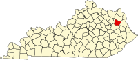 | |
| Unincorporated communities | ||
| ||
This Elliott County, Kentucky state location article is a stub. You can help Wikipedia by expanding it. |
Текст в блоке "Читать" взят с сайта "Википедия" и доступен по лицензии Creative Commons Attribution-ShareAlike; в отдельных случаях могут действовать дополнительные условия.
Другой контент может иметь иную лицензию. Перед использованием материалов сайта WikiSort.org внимательно изучите правила лицензирования конкретных элементов наполнения сайта.
Другой контент может иметь иную лицензию. Перед использованием материалов сайта WikiSort.org внимательно изучите правила лицензирования конкретных элементов наполнения сайта.
2019-2026
WikiSort.org - проект по пересортировке и дополнению контента Википедии
WikiSort.org - проект по пересортировке и дополнению контента Википедии