world.wikisort.org - USA
Inavale is an unincorporated community and census-designated place in western Webster County, Nebraska, United States. It lies along U.S. Route 136, west of the city of Red Cloud, the county seat of Webster County.[2] Its elevation is 1,736 feet (529 m).[3]
Inavale, Nebraska | |
|---|---|
census-designated place | |
 Blaine Street (U.S. Highway 136) in Inavale | |
 Inavale, Nebraska Location within the state of Nebraska | |
| Coordinates: 40°5′29″N 98°38′58″W | |
| Country | United States |
| State | Nebraska |
| County | Webster |
| Area | |
| • Total | 0.33 sq mi (0.86 km2) |
| • Land | 0.33 sq mi (0.86 km2) |
| • Water | 0.00 sq mi (0.00 km2) |
| Elevation | 1,736 ft (529 m) |
| Population (2020) | |
| • Total | 66 |
| • Density | 197.60/sq mi (76.32/km2) |
| Time zone | UTC-6 (Central (CST)) |
| • Summer (DST) | UTC-5 (CDT) |
| ZIP codes | 68952 |
| FIPS code | 31-23725 |
| GNIS feature ID | 830264 |
A post office was established at Invale in 1873, and remained in operation until it was discontinued in 1994.[4] Inavale retains the ZIP code of 68952.[5] The town's name is descriptive, from its setting in a vale.[6]
Demographics
| Historical population | |||
|---|---|---|---|
| Census | Pop. | %± | |
| 2020 | 66 | — | |
| U.S. Decennial Census[7] | |||
References
- "ArcGIS REST Services Directory". United States Census Bureau. Retrieved September 18, 2022.
- Rand McNally. The Road Atlas '08. Chicago: Rand McNally, 2008, p. 63.
- U.S. Geological Survey Geographic Names Information System: Inavale, Nebraska, Geographic Names Information System, 1979-03-09. Accessed 2008-04-26.
- "Webster County". Jim Forte Postal History. Retrieved 24 August 2014.
- Zip Code Lookup
- Fitzpatrick, Lillian L. (1960). Nebraska Place-Names. University of Nebraska Press. p. 145. ISBN 0-8032-5060-6. A 1925 edition is available for download at University of Nebraska—Lincoln Digital Commons.
- "Census of Population and Housing". Census.gov. Retrieved June 4, 2016.
Municipalities and communities of Webster County, Nebraska, United States | ||
|---|---|---|
County seat: Red Cloud | ||
| Cities | 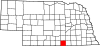 | |
| Villages | ||
| CDP | ||
| Unincorporated communities |
| |
| ||
This Webster County, Nebraska state location article is a stub. You can help Wikipedia by expanding it. |
Текст в блоке "Читать" взят с сайта "Википедия" и доступен по лицензии Creative Commons Attribution-ShareAlike; в отдельных случаях могут действовать дополнительные условия.
Другой контент может иметь иную лицензию. Перед использованием материалов сайта WikiSort.org внимательно изучите правила лицензирования конкретных элементов наполнения сайта.
Другой контент может иметь иную лицензию. Перед использованием материалов сайта WikiSort.org внимательно изучите правила лицензирования конкретных элементов наполнения сайта.
2019-2026
WikiSort.org - проект по пересортировке и дополнению контента Википедии
WikiSort.org - проект по пересортировке и дополнению контента Википедии