world.wikisort.org - USA
Hunterstown is an unincorporated community and census-designated place in Straban Township, Adams County, Pennsylvania, United States. As of the 2010 census the population was 547.[4]
Hunterstown, Pennsylvania | |
|---|---|
Census-designated place | |
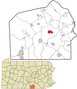 Location in Adams County and the state of Pennsylvania. | |
| Coordinates: 39°52′56″N 77°09′37″W | |
| Country | United States |
| State | Pennsylvania |
| County | Adams |
| Township | Straban |
| Area | |
| • Total | 1.73 sq mi (4.48 km2) |
| • Land | 1.72 sq mi (4.47 km2) |
| • Water | 0.01 sq mi (0.01 km2) |
| Elevation | 554 ft (169 m) |
| Population (2020)[2] | |
| • Total | 506 |
| • Density | 293.50/sq mi (113.31/km2) |
| Time zone | UTC-5 (Eastern (EST)) |
| • Summer (DST) | UTC-4 (EDT) |
| Area code | 717 |
| GNIS feature ID | 1177622[3] |
| FIPS code | 42-36352 |
Hunterstown is located along Pennsylvania Route 394 (Shrivers Corner Road), 5 miles (8 km) northeast of Gettysburg.
The Hunterstown Historic District and Great Conewago Presbyterian Church are listed on the National Register of Historic Places.[5]
During the Battle of Gettysburg in 1863 there was a brief cavalry skirmish at Hunterstown, today known as the Battle of Hunterstown.
Demographics
| Historical population | |||
|---|---|---|---|
| Census | Pop. | %± | |
| 2020 | 506 | — | |
| U.S. Decennial Census[6] | |||
References
- "ArcGIS REST Services Directory". United States Census Bureau. Retrieved October 12, 2022.
- "Census Population API". United States Census Bureau. Retrieved Oct 12, 2022.
- U.S. Geological Survey Geographic Names Information System: Hunterstown, Pennsylvania
- "Geographic Identifiers: 2010 Demographic Profile Data (G001): Hunterstown CDP, Pennsylvania". U.S. Census Bureau, American Factfinder. Archived from the original on February 12, 2020. Retrieved July 19, 2013.
- "National Register Information System". National Register of Historic Places. National Park Service. July 9, 2010.
- "Census of Population and Housing". Census.gov. Retrieved June 4, 2016.
External links
Municipalities and communities of Adams County, Pennsylvania, United States | ||
|---|---|---|
County seat: Gettysburg | ||
| Boroughs |  | |
| Townships | ||
| CDPs | ||
| Unincorporated communities |
| |
| Ghost town |
| |
| ||
Authority control | |
|---|---|
| General |
|
| National libraries | |
This Adams County, Pennsylvania state location article is a stub. You can help Wikipedia by expanding it. |
Текст в блоке "Читать" взят с сайта "Википедия" и доступен по лицензии Creative Commons Attribution-ShareAlike; в отдельных случаях могут действовать дополнительные условия.
Другой контент может иметь иную лицензию. Перед использованием материалов сайта WikiSort.org внимательно изучите правила лицензирования конкретных элементов наполнения сайта.
Другой контент может иметь иную лицензию. Перед использованием материалов сайта WikiSort.org внимательно изучите правила лицензирования конкретных элементов наполнения сайта.
2019-2026
WikiSort.org - проект по пересортировке и дополнению контента Википедии
WikiSort.org - проект по пересортировке и дополнению контента Википедии