world.wikisort.org - USA
Hot Springs is a census-designated place (CDP) in Bath County, Virginia, United States. The population as of the 2010 Census was 738.[1] It is located about 5 miles (8.0 kilometers) southwest of Warm Springs on U.S. Route 220.
Hot Springs, Virginia | |
|---|---|
Census-designated place | |
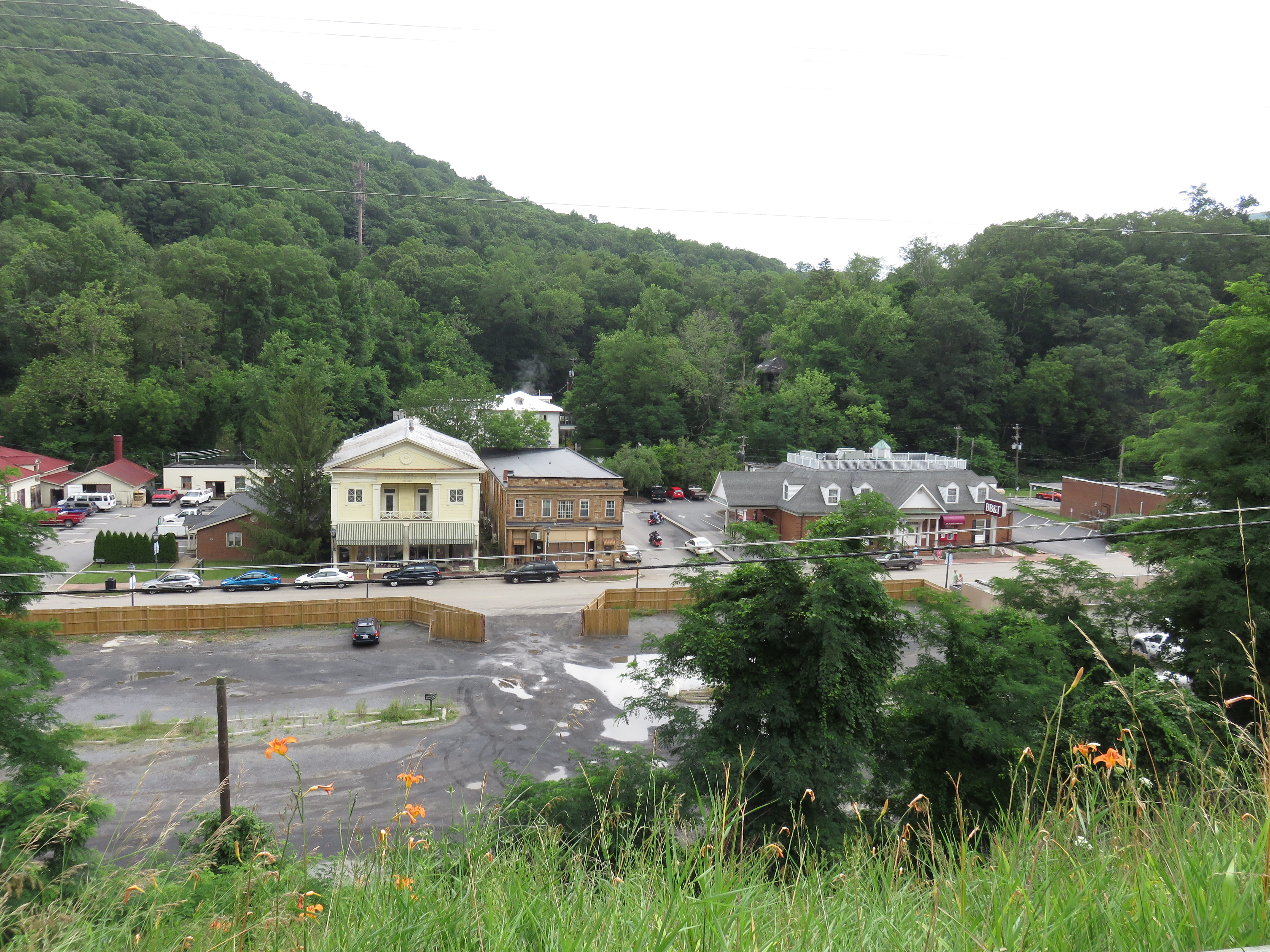
 Downtown Hot Springs in the late 2000s | |
 Hot Springs, Virginia Location within the U.S. state of Virginia  Hot Springs, Virginia Hot Springs, Virginia (the United States) | |
| Coordinates: 37°59′59″N 79°49′56″W | |
| Country | United States |
| State | Virginia |
| County | Bath |
| Population (2010) | |
| • Total | 738 |
| Time zone | UTC−5 (Eastern (EST)) |
| • Summer (DST) | UTC−4 (EDT) |
| ZIP codes | 24445 |
Hot Springs has several historic resorts, for the springs helped develop Bath County.
History
Since at least the mid 18th century, travelers came to use the springs. Thomas Bullitt built the first inn to accommodate them in 1766 and Dr. Thomas Goode later expanded it. The most prominent modern resort, The Homestead, traces its origin to this inn. Mustoe House, The Yard, Barton Lodge, Switchback School, and Garth Newel are also listed on the National Register of Historic Places.[2][3][4]
In 1943, during World War II, The Homestead hosted a United Nations conference which implemented the foundation of Food and Agriculture Organization.[5][6]
Climate
Hot springs has a (Dfb) climate type bordering on a (Dfa) and also, bordering on a (Cfa) Climate.
| Climate data for Hot Springs, Virginia (1991–2020 normals, extremes 1893–present) | |||||||||||||
|---|---|---|---|---|---|---|---|---|---|---|---|---|---|
| Month | Jan | Feb | Mar | Apr | May | Jun | Jul | Aug | Sep | Oct | Nov | Dec | Year |
| Record high °F (°C) | 73 (23) |
77 (25) |
83 (28) |
89 (32) |
94 (34) |
97 (36) |
99 (37) |
100 (38) |
95 (35) |
90 (32) |
79 (26) |
75 (24) |
100 (38) |
| Average high °F (°C) | 39.8 (4.3) |
43.7 (6.5) |
52.4 (11.3) |
64.2 (17.9) |
72.2 (22.3) |
78.8 (26.0) |
82.1 (27.8) |
80.4 (26.9) |
74.1 (23.4) |
64.0 (17.8) |
52.8 (11.6) |
42.9 (6.1) |
62.3 (16.8) |
| Daily mean °F (°C) | 30.6 (−0.8) |
33.5 (0.8) |
41.0 (5.0) |
51.5 (10.8) |
60.0 (15.6) |
67.6 (19.8) |
71.1 (21.7) |
69.7 (20.9) |
63.3 (17.4) |
52.5 (11.4) |
42.1 (5.6) |
34.1 (1.2) |
51.4 (10.8) |
| Average low °F (°C) | 21.5 (−5.8) |
23.3 (−4.8) |
29.6 (−1.3) |
38.8 (3.8) |
47.9 (8.8) |
56.4 (13.6) |
60.2 (15.7) |
59.1 (15.1) |
52.6 (11.4) |
41.0 (5.0) |
31.3 (−0.4) |
25.4 (−3.7) |
40.6 (4.8) |
| Record low °F (°C) | −20 (−29) |
−14 (−26) |
−2 (−19) |
10 (−12) |
18 (−8) |
25 (−4) |
35 (2) |
32 (0) |
22 (−6) |
14 (−10) |
0 (−18) |
−20 (−29) |
−20 (−29) |
| Average precipitation inches (mm) | 3.64 (92) |
3.13 (80) |
4.31 (109) |
4.30 (109) |
4.69 (119) |
4.31 (109) |
4.22 (107) |
3.59 (91) |
4.13 (105) |
3.14 (80) |
3.35 (85) |
3.69 (94) |
46.50 (1,181) |
| Average snowfall inches (cm) | 8.0 (20) |
7.0 (18) |
4.6 (12) |
0.5 (1.3) |
0.0 (0.0) |
0.0 (0.0) |
0.0 (0.0) |
0.0 (0.0) |
0.0 (0.0) |
0.1 (0.25) |
0.6 (1.5) |
4.5 (11) |
25.3 (64) |
| Average precipitation days (≥ 0.01 in) | 10.5 | 9.5 | 11.3 | 12.6 | 14.3 | 12.3 | 12.5 | 11.0 | 9.4 | 8.8 | 8.9 | 10.5 | 131.6 |
| Average snowy days (≥ 0.1 in) | 2.6 | 2.7 | 1.5 | 0.3 | 0.0 | 0.0 | 0.0 | 0.0 | 0.0 | 0.0 | 0.4 | 1.9 | 9.4 |
| Source: NOAA[7][8] | |||||||||||||
References
- Virginia Trend Report 2: State and Complete Places (Sub-state 2010 Census Data). Missouri Census Data Center. Accessed 2011-06-08.
- "National Register Information System". National Register of Historic Places. National Park Service. July 9, 2010.
- "National Register of Historic Places Listings". Weekly List of Actions Taken on Properties: 6/17/13 through 6/21/13. National Park Service. 2013-06-28.
- "National Register of Historic Places Listings". Weekly List of Actions Taken on Properties: 12/23/13 through 12/27/13. National Park Service. 2014-01-03. Archived from the original on 2014-02-19. Retrieved 2014-02-04.
- United Nations Conference on Food and Agriculture: Hot Springs, Virginia, May 18-June 3, 1943 : final act and section reports..
- "The founding of FAO"..
- "NowData – NOAA Online Weather Data". National Oceanic and Atmospheric Administration. Retrieved July 1, 2021.
- "Station: Hot Springs, VA". U.S. Climate Normals 2020: U.S. Monthly Climate Normals (1991-2020). National Oceanic and Atmospheric Administration. Retrieved July 1, 2021.
External links
- Vine Cottage Inn at Hot Springs
- "Taking the Waters: 19th Century Medicinal Springs: Hot Springs." Claude Moore Health Sciences Library, University of Virginia
Municipalities and communities of Bath County, Virginia, United States | ||
|---|---|---|
County seat: Warm Springs | ||
| CDPs |
|  |
| Unincorporated communities |
| |
| Footnotes | ‡This populated place also has portions in an adjacent county or counties | |
| ||
Authority control | |
|---|---|
| General | |
| National libraries | |
This Bath County, Virginia state location article is a stub. You can help Wikipedia by expanding it. |
Другой контент может иметь иную лицензию. Перед использованием материалов сайта WikiSort.org внимательно изучите правила лицензирования конкретных элементов наполнения сайта.
WikiSort.org - проект по пересортировке и дополнению контента Википедии