world.wikisort.org - USA
Homestead is a small unincorporated community in northern Blaine County, Oklahoma, United States. The town was plotted along the Rock Island railroad line before statehood. The Homestead Post Office opened January 26, 1893.[3] Homestead had a population of 150 residents in 1905, according to the Oklahoma Territorial Census.
Homestead, Oklahoma | |
|---|---|
Unincorporated community | |
 Location of Homestead in Oklahoma  Homestead, Oklahoma (the United States) | |
| Coordinates: 36°08′59″N 98°23′38″W | |
| Country | United States |
| State | Oklahoma |
| County | Blaine |
| Area | |
| • Total | 0.76 sq mi (1.96 km2) |
| • Land | 0.76 sq mi (1.96 km2) |
| • Water | 0.00 sq mi (0.00 km2) |
| Elevation | 1,250 ft (380 m) |
| Population (2020) | |
| • Total | 41 |
| • Density | 54.16/sq mi (20.90/km2) |
| Time zone | UTC-6 (Central (CST)) |
| • Summer (DST) | UTC-5 (CDT) |
| Area code | 580 |
| FIPS code | 40-35800 |
| GNIS feature ID | 1093872[2] |
Demographics
| Historical population | |||
|---|---|---|---|
| Census | Pop. | %± | |
| 2020 | 41 | — | |
| U.S. Decennial Census[4] | |||
References
- "ArcGIS REST Services Directory". United States Census Bureau. Retrieved September 20, 2022.
- U.S. Geological Survey Geographic Names Information System: Homestead, Oklahoma. Retrieved on 2008-05-16.
- Shirk, George H. Oklahoma Place Names, Norman, Oklahoma: University of Oklahoma Press, 1965, p.105.
- "Census of Population and Housing". Census.gov. Retrieved June 4, 2016.
Further reading
- Shirk, George H. Oklahoma Place Names. Norman: University of Oklahoma Press, 1987. ISBN 0-8061-2028-2 .
Municipalities and communities of Blaine County, Oklahoma, United States | ||
|---|---|---|
County seat: Watonga | ||
| Cities | 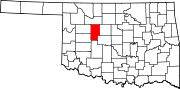 | |
| Towns | ||
| CDPs | ||
| Other community | ||
| Footnotes | ‡This populated place also has portions in an adjacent county or counties | |
| ||
This Oklahoma state location article is a stub. You can help Wikipedia by expanding it. |
Текст в блоке "Читать" взят с сайта "Википедия" и доступен по лицензии Creative Commons Attribution-ShareAlike; в отдельных случаях могут действовать дополнительные условия.
Другой контент может иметь иную лицензию. Перед использованием материалов сайта WikiSort.org внимательно изучите правила лицензирования конкретных элементов наполнения сайта.
Другой контент может иметь иную лицензию. Перед использованием материалов сайта WikiSort.org внимательно изучите правила лицензирования конкретных элементов наполнения сайта.
2019-2026
WikiSort.org - проект по пересортировке и дополнению контента Википедии
WikiSort.org - проект по пересортировке и дополнению контента Википедии