world.wikisort.org - USA
Hazel Green (also Tribles Store) is a census-designated place and unincorporated community in Wolfe County, Kentucky, United States. It lies along Routes 191 and 205 northeast of the city of Campton, the county seat of Wolfe County.[2] Its elevation is 922 feet (281 m).[3] It has a post office with the ZIP code 41332.[4]
Hazel Green | |
|---|---|
Unincorporated community & census-designated place | |
| Nickname(s): Trimble's Store | |
 Hazel Green Location within the state of Kentucky  Hazel Green Hazel Green (the United States) | |
| Coordinates: 37°47′51″N 83°25′0″W | |
| Country | United States |
| State | Kentucky |
| County | Wolfe |
| Area | |
| • Total | 1.08 sq mi (2.79 km2) |
| • Land | 1.08 sq mi (2.79 km2) |
| • Water | 0.00 sq mi (0.01 km2) |
| Elevation | 922 ft (281 m) |
| Population (2020) | |
| • Total | 173 |
| • Density | 160.78/sq mi (62.10/km2) |
| Time zone | UTC-5 (Eastern (EST)) |
| • Summer (DST) | UTC-4 (EDT) |
| ZIP codes | 41332 |
| FIPS code | 21-35398 |
| GNIS feature ID | 493953 |
A post office was established as Hazle Green [sic] in 1829, and named for the hazel shrubs prevalent in the area. The name of the post office was officially changed to its present spelling in 1889.[5]
Demographics
| Historical population | |||
|---|---|---|---|
| Census | Pop. | %± | |
| 2020 | 173 | — | |
| U.S. Decennial Census[6] | |||
Notable person
- Pete Center, baseball player.
- South Trimble U.S. House of Representatives -Longest serving Clerk of the House of Representatives
References
- "2020 U.S. Gazetteer Files". United States Census Bureau. Retrieved March 18, 2022.
- Rand McNally. The Road Atlas '06. Chicago: Rand McNally, 2006, p. 43.
- U.S. Geological Survey Geographic Names Information System: Hazel Green, Kentucky, Geographic Names Information System, 1979-09-20. Accessed 2008-01-03.
- USPS – Cities by ZIP Code
- Rennick, Robert M. (1987). Kentucky Place Names. University Press of Kentucky. p. 135. ISBN 0813126312. Retrieved 2013-04-28.
- "Census of Population and Housing". Census.gov. Retrieved June 4, 2016.
External links
- Digitized images from the Pearl Day Bach Photographic Collection, 1893-1961 housed at the University of Kentucky Libraries Special Collections Research Center
Municipalities and communities of Wolfe County, Kentucky, United States | ||
|---|---|---|
County seat: Campton | ||
| City | 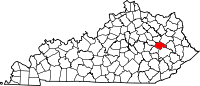 | |
| CDP | ||
| Other unincorporated communities | ||
| ||
Authority control | |
|---|---|
| General |
|
| National libraries | |
This Wolfe County, Kentucky state location article is a stub. You can help Wikipedia by expanding it. |
Текст в блоке "Читать" взят с сайта "Википедия" и доступен по лицензии Creative Commons Attribution-ShareAlike; в отдельных случаях могут действовать дополнительные условия.
Другой контент может иметь иную лицензию. Перед использованием материалов сайта WikiSort.org внимательно изучите правила лицензирования конкретных элементов наполнения сайта.
Другой контент может иметь иную лицензию. Перед использованием материалов сайта WikiSort.org внимательно изучите правила лицензирования конкретных элементов наполнения сайта.
2019-2026
WikiSort.org - проект по пересортировке и дополнению контента Википедии
WikiSort.org - проект по пересортировке и дополнению контента Википедии