world.wikisort.org - USA
Haverhill is an unincorporated community in Butler County, Kansas, United States.[1] It is located about 4.5 miles (7.2 km) east of Augusta.
Haverhill, Kansas | |
|---|---|
Unincorporated community | |
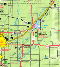 KDOT map of Butler County (legend) | |
 Haverhill  Haverhill | |
| Coordinates: 37°41′8″N 96°52′59″W[1] | |
| Country | United States |
| State | Kansas |
| County | Butler |
| Elevation | 1,326 ft (404 m) |
| Time zone | UTC-6 (CST) |
| • Summer (DST) | UTC-5 (CDT) |
| FIPS code | 20-30800 [1] |
| GNIS ID | 474818 [1] |
History
A post office was opened in Haverhill in 1880, and remained in operation until it was discontinued in 1933.[2]
Haverhill was a station and shipping point on the St. Louis–San Francisco Railway.[3]
Education
The community is served by Bluestem USD 205 public school district.
References
- "Haverhill, Kansas", Geographic Names Information System, United States Geological Survey
- "Kansas Post Offices, 1828-1961 (archived)". Kansas Historicall Society. Archived from the original on 9 October 2013. Retrieved 5 June 2014.
- Blackmar, Frank Wilson (1912). Kansas: A Cyclopedia of State History, Embracing Events, Institutions, Industries, Counties, Cities, Towns, Prominent Persons, Etc. Standard Publishing Company. pp. 831.
Further reading
External links
Municipalities and communities of Butler County, Kansas, United States | ||
|---|---|---|
County seat: El Dorado | ||
| Cities |  | |
| Unincorporated communities |
| |
| Ghost towns |
| |
| Townships | ||
| Footnotes | †This community is designated a Census-Designated Place (CDP) by the United States Census Bureau. ‡This community also has portions in an adjacent county or counties. | |
| ||
Текст в блоке "Читать" взят с сайта "Википедия" и доступен по лицензии Creative Commons Attribution-ShareAlike; в отдельных случаях могут действовать дополнительные условия.
Другой контент может иметь иную лицензию. Перед использованием материалов сайта WikiSort.org внимательно изучите правила лицензирования конкретных элементов наполнения сайта.
Другой контент может иметь иную лицензию. Перед использованием материалов сайта WikiSort.org внимательно изучите правила лицензирования конкретных элементов наполнения сайта.
2019-2026
WikiSort.org - проект по пересортировке и дополнению контента Википедии
WikiSort.org - проект по пересортировке и дополнению контента Википедии