world.wikisort.org - USA
Happy Valley is an unincorporated community and census-designated place in Eddy County, New Mexico, United States. Its population was 519 as of the 2010 census.[4] The community is located on the western edge of Carlsbad; New Mexico State Road 524 passes through the area. The town was settled as a farming community before potash was manufactured here. It was named because the lack of land use regulations made residents happy.[5]
Happy Valley, New Mexico | |
|---|---|
Census-designated place | |
 Happy Valley | |
| Coordinates: 32°25′26″N 104°17′27″W | |
| Country | United States |
| State | New Mexico |
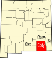
| County | Eddy |
| Area | |
| • Total | 2.15 sq mi (5.56 km2) |
| • Land | 2.15 sq mi (5.56 km2) |
| • Water | 0.00 sq mi (0.01 km2) |
| Elevation | 3,209 ft (978 m) |
| Population (2020)[2] | |
| • Total | 617 |
| • Density | 287.65/sq mi (111.06/km2) |
| Time zone | UTC-7 (Mountain (MST)) |
| • Summer (DST) | UTC-6 (MDT) |
| Area code | 575 |
| GNIS feature ID | 2584108[3] |
Geography
Happy Valley is located at 32.423909°N 104.290790°W. According to the U.S. Census Bureau, the community has an area of 2.159 square miles (5.59 km2), of which 2.156 square miles (5.58 km2) are land and 0.003 square miles (0.0078 km2) are water.[4]
Demographics
| Historical population | |||
|---|---|---|---|
| Census | Pop. | %± | |
| 2020 | 617 | — | |
| U.S. Decennial Census[6][2] | |||
Education
It is within the Carlsbad Municipal School District,[7] which operates Carlsbad High School.
References
- "ArcGIS REST Services Directory". United States Census Bureau. Retrieved October 12, 2022.
- "Census Population API". United States Census Bureau. Retrieved Oct 12, 2022.
- "Happy Valley Census Designated Place". Geographic Names Information System. United States Geological Survey, United States Department of the Interior.
- "2010 Census Gazetteer Files - Places: New Mexico". U.S. Census Bureau. Retrieved December 7, 2015.
- Julyan, Robert (1996). The Place Names of New Mexico. University of New Mexico Press. p. 161. ISBN 0826316891.
- "Census of Population and Housing". Census.gov. Retrieved June 4, 2016.
- "2020 CENSUS - SCHOOL DISTRICT REFERENCE MAP: Eddy County, NM" (PDF). U.S. Census Bureau. Retrieved 2022-06-28.
Municipalities and communities of Eddy County, New Mexico, United States | ||
|---|---|---|
County seat: Carlsbad | ||
| Cities |
|  |
| Villages | ||
| CDPs | ||
| Unincorporated communities | ||
| ||
This New Mexico state location article is a stub. You can help Wikipedia by expanding it. |
Другой контент может иметь иную лицензию. Перед использованием материалов сайта WikiSort.org внимательно изучите правила лицензирования конкретных элементов наполнения сайта.
WikiSort.org - проект по пересортировке и дополнению контента Википедии