world.wikisort.org - USA
Gooseberry is an unincorporated community in Morrow County, Oregon, United States. Gooseberry lies along Ione–Gooseberry Road near its intersection with Oregon Route 206 between Heppner to the east and Condon to the west.[2]
Gooseberry, Oregon | |
|---|---|
Unincorporated community | |
 Gooseberry, Oregon  Gooseberry, Oregon | |
| Coordinates: 45°17′32″N 119°53′31″W | |
| Country | United States |
| State | Oregon |
| County | Morrow |
| Elevation | 2,438 ft (743 m) |
| Time zone | UTC-8 (Pacific (PST)) |
| • Summer (DST) | UTC-7 (PDT) |
| Area code(s) | 458 and 541 |
| GNIS feature ID | 1136327[1] |
| Coordinates and elevation from the Geographic Names Information System (GNIS)[1] | |
Cattlemen began referring to the location as Gooseberry Spring as early as 1872. Its name came from a large wild gooseberry bush near the spring. A Gooseberry post office operated in the community from 1884 through 1918.[3]
References
- "Gooseberry". Geographic Names Information System. United States Geological Survey. November 28, 1980. Retrieved October 18, 2016.
- Oregon Atlas & Gazetteer (7th ed.). Yarmouth, Maine: DeLorme. 2008. p. 73. ISBN 978-0-89933-347-2.
- McArthur, Lewis A.; Lewis L. McArthur (2003) [1928]. Oregon Geographic Names (7th ed.). Portland, Oregon: Oregon Historical Society Press. p. 413. ISBN 0-87595-277-1.
Municipalities and communities of Morrow County, Oregon, United States | ||
|---|---|---|
County seat: Heppner | ||
| Cities | 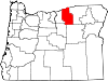 | |
| Unincorporated communities | ||
| Ghost town | ||
| ||
This Morrow County, Oregon state location article is a stub. You can help Wikipedia by expanding it. |
Текст в блоке "Читать" взят с сайта "Википедия" и доступен по лицензии Creative Commons Attribution-ShareAlike; в отдельных случаях могут действовать дополнительные условия.
Другой контент может иметь иную лицензию. Перед использованием материалов сайта WikiSort.org внимательно изучите правила лицензирования конкретных элементов наполнения сайта.
Другой контент может иметь иную лицензию. Перед использованием материалов сайта WikiSort.org внимательно изучите правила лицензирования конкретных элементов наполнения сайта.
2019-2026
WikiSort.org - проект по пересортировке и дополнению контента Википедии
WikiSort.org - проект по пересортировке и дополнению контента Википедии