world.wikisort.org - USA
Glenwood is an unincorporated community and census-designated place (CDP) in Klickitat County, Washington, United States. It is 26.5 miles (42.6 km) west-northwest of Goldendale and has a post office with ZIP code 98619.[2] The community is on land whose jurisdiction is disputed between the Yakama Nation and Klickitat County.[3]
Glenwood, Washington | |
|---|---|
Census-designated place | |
 Glenwood  Glenwood | |
| Coordinates: 46°01′07″N 121°17′26″W | |
| Country | United States |
| State | Washington |
| County | Klickitat |
| Elevation | 1,900 ft (600 m) |
| Time zone | UTC-8 (Pacific (PST)) |
| • Summer (DST) | UTC-7 (PDT) |
| ZIP code | 98619 |
| Area code | 509 |
| FIPS code | 53-27226 |
| GNIS feature ID | 1520005[1] |
The community was named for the glen and woods near the original town site.[4]
Glenwood was the site of a fatal black bear attack of four year old Victoria Valdez near her home in 1974.[5]
The population of Glenwood in 2020 was 179.
Climate
Glenwood has a warm-summer Mediterranean climate (Csb) according to the Köppen climate classification system.
| Climate data for Glenwood, elev. 1,900 feet (579 m) | |||||||||||||
|---|---|---|---|---|---|---|---|---|---|---|---|---|---|
| Month | Jan | Feb | Mar | Apr | May | Jun | Jul | Aug | Sep | Oct | Nov | Dec | Year |
| Record high °F (°C) | 59 (15) |
68 (20) |
74 (23) |
85 (29) |
97 (36) |
98 (37) |
101 (38) |
100 (38) |
99 (37) |
87 (31) |
70 (21) |
57 (14) |
101 (38) |
| Average high °F (°C) | 38.4 (3.6) |
42.9 (6.1) |
50.3 (10.2) |
57 (14) |
65.4 (18.6) |
71.5 (21.9) |
80 (27) |
81.1 (27.3) |
73.7 (23.2) |
60.9 (16.1) |
46 (8) |
36.9 (2.7) |
58.7 (14.8) |
| Average low °F (°C) | 23.5 (−4.7) |
24.5 (−4.2) |
28.2 (−2.1) |
30.2 (−1.0) |
34.8 (1.6) |
39.9 (4.4) |
42.9 (6.1) |
42.1 (5.6) |
35 (2) |
29.2 (−1.6) |
27.4 (−2.6) |
22.7 (−5.2) |
31.7 (−0.2) |
| Record low °F (°C) | −24 (−31) |
−18 (−28) |
3 (−16) |
11 (−12) |
14 (−10) |
22 (−6) |
28 (−2) |
25 (−4) |
16 (−9) |
−1 (−18) |
−22 (−30) |
−27 (−33) |
−27 (−33) |
| Average precipitation inches (mm) | 5.41 (137) |
3.85 (98) |
3 (76) |
1.55 (39) |
1.09 (28) |
0.77 (20) |
0.22 (5.6) |
0.25 (6.4) |
0.8 (20) |
2.01 (51) |
4.97 (126) |
5.99 (152) |
29.91 (760) |
| Average snowfall inches (cm) | 18.5 (47) |
9.5 (24) |
5.2 (13) |
0.4 (1.0) |
0 (0) |
0 (0) |
0 (0) |
0 (0) |
0 (0) |
0.2 (0.51) |
6.7 (17) |
20.5 (52) |
60.9 (155) |
| Average precipitation days | 13 | 10 | 11 | 8 | 5 | 4 | 2 | 1 | 4 | 7 | 13 | 13 | 91 |
| Source: Western Regional Climate Center (1979-2014) [6] | |||||||||||||
Land dispute
Ownership of this area has been in dispute dating back to the Treaty of 1855. An 1890 survey of the Yakama Reservation, accepted by the General Land Office, did not include the area known as "Tract-D". The original treaty map, which included the Tract-D area, was found in 1930 after being misplaced for decades. In the meantime 98,000 acres (400 km2) of the Glenwood Valley had passed into private ownership. Another 21,000 acres (85 km2) were part of the Gifford Pinchot National Forest administered by the United States Department of Agriculture. After more than 100 years of dispute, in 1972 President Richard Nixon by Executive Order 11670 authorized the return of the 21,000 acre portion of Mt. Adams, including the summit, to the Yakama Nation. The area returned to the Yakama Nation did not include the 98,000 acres of Tract D in the Glenwood Valley.[7] The Yakama Nation accepted $2.1 million in 1970 for their claims.[8]
In 2022, Klickitat County’s claim that Glenwood is not part of the Yakama reservation was rejected by the United States Supreme Court.
References
- http://www.glenwoodwashingtonweather.info/
- http://www.goldendalesentinel.com/story/2015/04/29/news/glenwood-fights-to-avoid-being-absorbed-into-indian-lands/5805.html
- http://www.wsdot.wa.gov/mapsdata/geodatacatalog/Maps/noscale/DOT_Cartog/TribalLands.htm
- U.S. Geological Survey Geographic Names Information System: Glenwood, Klickitat County, Washington
- ZIP Code Lookup
- "Glenwood fights to avoid being absorbed into Indian lands".
- Meany, Edmond S. (1923). Origin of Washington geographic names. Seattle: University of Washington Press. p. 98.
- Sandberry, Scott (May 7, 2014). "Bear conflicts spike in spring as hibernation ends". Yakima Herald-Republic. Retrieved September 30, 2019.
{{cite web}}: CS1 maint: url-status (link) - "Glenwood #2, WASHINGTON (453184)". Western Regional Climate Center. Retrieved November 16, 2015.
- "Indian Reservation Boundaries of Washington State". www.wsdot.wa.gov. Archived from the original on 2014-07-10.
- "Glenwood fights to avoid being absorbed into Indian lands".
Municipalities and communities of Klickitat County, Washington, United States | ||
|---|---|---|
County seat: Goldendale | ||
| Cities | 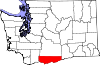 | |
| CDPs | ||
| Unincorporated communities | ||
| Ghost towns |
| |
| Indian reservation |
| |
| Footnotes | ‡This populated place also has portions in an adjacent county or counties | |
| ||
This Klickitat County, Washington state location article is a stub. You can help Wikipedia by expanding it. |
Другой контент может иметь иную лицензию. Перед использованием материалов сайта WikiSort.org внимательно изучите правила лицензирования конкретных элементов наполнения сайта.
WikiSort.org - проект по пересортировке и дополнению контента Википедии