world.wikisort.org - USA
Gay is an unincorporated community in Choctaw County, Oklahoma, United States.[1]
Gay, Oklahoma | |
|---|---|
Unincorporated community | |
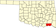
 Gay Location within the state of Oklahoma  Gay Gay (the United States) | |
| Coordinates: 33°57′12″N 95°37′17″W | |
| Country | United States |
| State | Oklahoma |
| County | Choctaw |
| Elevation | 443 ft (135 m) |
| Time zone | UTC-6 (Central (CST)) |
| • Summer (DST) | UTC-5 (CDT) |
| GNIS feature ID | 1093152[1] |
History
A post office was established at Lenton, Indian Territory on October 22, 1901. Its name changed to Gay, Oklahoma on April 28, 1908. The post office closed on December 31, 1932.[2]
The community is said to have been named after the town of Gay, Georgia.[3]
At the time it was founded, Lenton, later Gay, was located in Kiamitia County, a part of the Apukshunnubbee District of the Choctaw Nation.[4]
Notable person
- Pauline Short Robinson (1915–1997), first African-American librarian in Denver, Colorado
References
- U.S. Geological Survey Geographic Names Information System: Gay, Oklahoma
- Shirk, George H. Oklahoma Place Names (Norman: University of Oklahoma, 1965), pp. 87 & 124.
- Shirk, George H. (1 January 1987). Oklahoma Place Names. University of Oklahoma Press. p. 98. ISBN 978-0-8061-2028-7.
- Morris, John W. Historical Atlas of Oklahoma (Norman: University of Oklahoma, 1986), plate 38.
Municipalities and communities of Choctaw County, Oklahoma, United States | ||
|---|---|---|
County seat: Hugo | ||
| City |
|  |
| Towns | ||
| CDPs |
| |
| Other unincorporated communities |
| |
| Indian reservation |
| |
| Footnotes | ‡This populated place also has portions in another county or counties | |
| ||
This Oklahoma state location article is a stub. You can help Wikipedia by expanding it. |
Текст в блоке "Читать" взят с сайта "Википедия" и доступен по лицензии Creative Commons Attribution-ShareAlike; в отдельных случаях могут действовать дополнительные условия.
Другой контент может иметь иную лицензию. Перед использованием материалов сайта WikiSort.org внимательно изучите правила лицензирования конкретных элементов наполнения сайта.
Другой контент может иметь иную лицензию. Перед использованием материалов сайта WikiSort.org внимательно изучите правила лицензирования конкретных элементов наполнения сайта.
2019-2026
WikiSort.org - проект по пересортировке и дополнению контента Википедии
WikiSort.org - проект по пересортировке и дополнению контента Википедии