world.wikisort.org - USA
Fruitdale is an unincorporated community in Jackson Township, Brown County, in the U.S. state of Indiana.[3]
Fruitdale, Indiana | |
|---|---|
Unincorporated community | |
 Brown County's location in Indiana | |
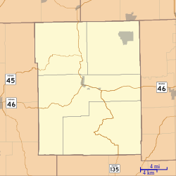 Fruitdale Location in Brown County | |
| Coordinates: 39°19′19″N 86°15′28″W | |
| Country | United States |
| State | Indiana |
| County | Brown |
| Township | Jackson |
| Elevation | 843 ft (257 m) |
| Time zone | UTC-5 (Eastern (EST)) |
| • Summer (DST) | UTC-4 (EDT) |
| ZIP code | 46160 |
| Area code(s) | 812 & 930 |
| FIPS code | 18-26080[2] |
| GNIS feature ID | 434882 |
History
A post office was established at Fruitdale in 1909, and remained in operation until 1937.[4] The community was likely named from fruit orchards nearby.[5]
Geography
Fruitdale is located at 39°19′19″N 86°15′28″W.
References
- "US Board on Geographic Names". United States Geological Survey. 2007-10-25. Retrieved 2008-01-31.
- "U.S. Census website". United States Census Bureau. Retrieved 2008-01-31.
- "Fruitdale, Indiana". Geographic Names Information System. United States Geological Survey. Retrieved March 7, 2020.
- "Brown County". Jim Forte Postal History. Archived from the original on 3 September 2014. Retrieved 28 August 2014.
- Baker, Ronald L. (October 1995). From Needmore to Prosperity: Hoosier Place Names in Folklore and History. Indiana University Press. p. 140. ISBN 978-0-253-32866-3.
...it is generally believed that it comes from the location of the village, in the fruit belt.
Municipalities and communities of Brown County, Indiana, United States | ||
|---|---|---|
County seat: Nashville | ||
| Town |
|  |
| Townships |
| |
| CDP | ||
| Other communities |
| |
| Footnotes | ‡This populated place also has portions in an adjacent county or counties | |
| ||
This Brown County, Indiana location article is a stub. You can help Wikipedia by expanding it. |
Текст в блоке "Читать" взят с сайта "Википедия" и доступен по лицензии Creative Commons Attribution-ShareAlike; в отдельных случаях могут действовать дополнительные условия.
Другой контент может иметь иную лицензию. Перед использованием материалов сайта WikiSort.org внимательно изучите правила лицензирования конкретных элементов наполнения сайта.
Другой контент может иметь иную лицензию. Перед использованием материалов сайта WikiSort.org внимательно изучите правила лицензирования конкретных элементов наполнения сайта.
2019-2026
WikiSort.org - проект по пересортировке и дополнению контента Википедии
WikiSort.org - проект по пересортировке и дополнению контента Википедии