world.wikisort.org - USA
Fairport is an unincorporated community in Paradise Township, Russell County, Kansas, United States.[1] It is located about 12 miles north of Gorham near the west county line and next the Saline River.
Fairport, Kansas | |
|---|---|
Unincorporated community | |
 KDOT map of Russell County (legend) | |
 Fairport  Fairport | |
| Coordinates: 39°02′45″N 99°01′50″W[1] | |
| Country | United States |
| State | Kansas |
| County | Russell |
| Founded | 1870s |
| Elevation | 1,680 ft (510 m) |
| Time zone | UTC-6 (CST) |
| • Summer (DST) | UTC-5 (CDT) |
| ZIP code | 67665 |
| Area code | 785 |
| FIPS code | 20-22375 [1] |
| GNIS ID | 472526 [1] |
History
In 1879, Knight & Bradshaw built Fairport Mills, a steam and water-powered flour mill, at a site on the Saline River northwest of Russell, Kansas.[2] A rural post office had opened near the site in October 1878 under the name Clarkson, but changed its name to Fairport in 1881.[3] The community of Fairport grew up around the mill and, by 1910, had local trade and a population of 75.[4] The post office closed in 1959.[3]
Geography
Fairport is located at 39°02′45″N 99°01′50″W (39.0458446, -99.0306464) at an elevation of 1,680 feet (512 m).[1] It lies in the Smoky Hills region of the Great Plains on the Saline River which wraps around the east, north, and west sides of the town in a meander.[5][6] Fairport is roughly 14 miles (22 km) northwest of Russell, the county seat.[6]
Education
Fairport had a two year high school in connection with the common school until 1940 when Fairport High School joined Paradise High School.[7]
Transportation
Paradise-Fairport Road, an unpaved east–west county road, enters Fairport from the east, turns north through the town, then turns west and exits the town, becoming Fairport-Natoma Road.[6][8]
References
- "Fairport, Kansas", Geographic Names Information System, United States Geological Survey, United States Department of the Interior
- Cutler, William G. (1883), "Russell County, Part 2", History of the State of Kansas, Chicago: A.T. Andreas
- "Post Offices in Kansas". Kansas State Historical Society. Retrieved 2010-08-11.
- Blackmar, Frank W., ed. (1912). "Fairport". Kansas: a cyclopedia of state history, embracing events, institutions, industries, counties, cities, towns, prominent persons, etc. Vol. 1. Chicago: Standard. p. 620.
{{cite book}}: CS1 maint: postscript (link) - "2003-2004 Official Transportation Map" (PDF). Kansas Department of Transportation. 2003. Retrieved 2010-12-12.
- "General Highway Map - Russell County, Kansas" (PDF). Kansas Department of Transportation. 2010-10-01. Retrieved 2010-12-12.
- "Fairport High School Joins Paradise District", Natoma Independent, 11 April 1940, p.1
- "Fairport, KS 67665". Google Maps. Retrieved 2010-12-12.
Further reading
External links
Municipalities and communities of Russell County, Kansas, United States | ||
|---|---|---|
County seat: Russell | ||
| Cities | 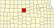 | |
| Unincorporated communities | ||
| Ghost towns | ||
| Townships | ||
| Footnotes | ‡This community also has portions in an adjacent county or counties. | |
| ||
Другой контент может иметь иную лицензию. Перед использованием материалов сайта WikiSort.org внимательно изучите правила лицензирования конкретных элементов наполнения сайта.
WikiSort.org - проект по пересортировке и дополнению контента Википедии