world.wikisort.org - USA
Fairfield is a town in Utah County, Utah, United States. It is part of the Provo–Orem, Utah Metropolitan Statistical Area. It is located in the southwest corner of Cedar Valley about 50 miles (80 km) southwest of Salt Lake City and 5 miles (8.0 km) south of Cedar Fort on Utah State Route 73, west of Utah Lake. The population was 119 at the 2010 census.
Fairfield | |
|---|---|
Town | |
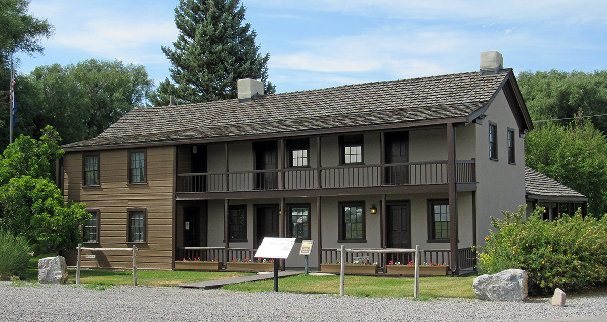
 Old Fairfield Schoolhouse | |
 Location in Utah County and the state of Utah | |
| Coordinates: 40°15′44″N 112°05′35″W | |
| Country | United States |
| State | Utah |
| County | Utah |
| Founded | 1855 |
| Incorporated | December 20, 2004[1] |
| Founded by | John Carson |
| Named for | Amos Fielding |
| Area | |
| • Total | 26.11 sq mi (67.63 km2) |
| • Land | 26.09 sq mi (67.56 km2) |
| • Water | 0.03 sq mi (0.07 km2) |
| Elevation | 4,879 ft (1,487 m) |
| Population (2010)[3] | |
| • Total | 119 |
| • Estimate (2019)[4] | 145 |
| • Density | 5.56/sq mi (2.15/km2) |
| Time zone | UTC-7 (Mountain (MST)) |
| • Summer (DST) | UTC-6 (MDT) |
| ZIP code | 84013 |
| Area code(s) | 385, 801 |
| GNIS feature ID | 1427871[1] |
History
The town was founded in 1855 when John Carson, his four brothers, and others settled in the Cedar Valley. The settlement was soon known as Frogtown. The population ballooned after the arrival of Johnston's Army in 1858-59, sent to Utah to suppress the rumored rebellion there. The army established a nearby camp called Camp Floyd, and the population grew to over 7,000, including 3,500 troops (nearly one-third of the entire U.S. Army at that time), teamsters, gamblers, and camp followers of various persuasions. With no rebellion taking place, the troops were recalled in 1861 and sent east to fight for the Union with the outbreak of the Civil War.[5]
Frogtown became Fairfield in 1861, named after Amos Fielding, who had participated in establishing the community.
The Stagecoach Inn, located in Fairfield and now a museum, was used by travelers passing through via stagecoach, military personnel, and riders on the Pony Express trail.
Fairfield was incorporated in 2004 due to concerns about growth from surrounding communities.[6] Besides agriculture, the town is a destination for Camp Floyd tourists and home to a large construction landfill.
Demographics
| Historical population | |||
|---|---|---|---|
| Census | Pop. | %± | |
| 1860 | 303 | — | |
| 1870 | 223 | −26.4% | |
| 1880 | 172 | −22.9% | |
| 1890 | 273 | 58.7% | |
| 1900 | 168 | −38.5% | |
| 1910 | 279 | 66.1% | |
| 1920 | 95 | −65.9% | |
| 1930 | 129 | 35.8% | |
| 1940 | 93 | −27.9% | |
| 1950 | 99 | 6.5% | |
| 2010 | 119 | — | |
| 2019 (est.) | 145 | [4] | 21.8% |
| Source: U.S. Census Bureau[7] | |||
As of the census[3] of 2010, 119 people lived in the town. There were 41 housing units. The racial makeup was 95.8% White, 1.7% from some other race, and 2.5% from two or more races. Hispanic or Latino of any race were 4.2% of the population.
See also
 Utah portal
- List of cities and towns in Utah
- Utah War
References
- U.S. Geological Survey Geographic Names Information System: Fairfield. Retrieved January 5, 2012.
- "2019 U.S. Gazetteer Files". United States Census Bureau. Retrieved August 7, 2020.
- "U.S. Census website". United States Census Bureau. Retrieved January 5, 2012.
- "Population and Housing Unit Estimates". United States Census Bureau. May 24, 2020. Retrieved May 27, 2020.
- "Camp Floyd / Stagecoach Inn State Park and Museum". Utah State Parks. Archived from the original on May 12, 2012. Retrieved January 5, 2012.
- Haddock, Sharon (November 1, 2004). "Burg eager to be a town". Deseret News. Retrieved January 5, 2012.
- "Census of Population and Housing". U.S. Census Bureau. Retrieved November 18, 2011.
External links
![]() Media related to Fairfield, Utah at Wikimedia Commons
Media related to Fairfield, Utah at Wikimedia Commons
Places adjacent to Fairfield, Utah | ||||||||||||||||
|---|---|---|---|---|---|---|---|---|---|---|---|---|---|---|---|---|
| ||||||||||||||||
Municipalities and communities of Utah County, Utah, United States | ||
|---|---|---|
County seat: Provo | ||
| Cities |  | |
| Towns | ||
| CDPs | ||
| Other communities |
| |
| Indian reservation |
| |
| Ghost towns | ||
| Footnotes | ‡This populated place also has portions in an adjacent county or counties | |
| ||
Authority control | |
|---|---|
| General |
|
| National libraries | |
Другой контент может иметь иную лицензию. Перед использованием материалов сайта WikiSort.org внимательно изучите правила лицензирования конкретных элементов наполнения сайта.
WikiSort.org - проект по пересортировке и дополнению контента Википедии