world.wikisort.org - USA
Ethridge is an unincorporated community in Toole County, Montana, United States. It is located 12.6 miles (20.3 km) west-northwest of Shelby. It is located on U.S. Route 2, and is a grain storage and shipping point on the Hi-Line. The community has a post office with ZIP code 59435.[2][3]
Ethridge, Montana | |
|---|---|
Unincorporated community | |
 Ethridge, Montana  Ethridge, Montana | |
| Coordinates: 48°33′28″N 112°07′14″W | |
| Country | United States |
| State | Montana |
| County | Toole |
| Government | |
| • Founder | George A. Norman |
| Elevation | 3,543 ft (1,080 m) |
| Time zone | UTC-7 (Mountain (MST)) |
| • Summer (DST) | UTC-6 (MDT) |
| ZIP code | 59435 |
| Area code(s) | 406 |
| GNIS feature ID | 771247[1] |
Glacier Wind Farm is located south of Ethridge off U.S. Route 2, between the cities of Cut Bank and Shelby, and spans about 25,000 acres.[4]
Sometime in early 1900, the Great Northern Railway station named Galt was renamed Ethridge.[5]
References
- "Ethridge". Geographic Names Information System. United States Geological Survey, United States Department of the Interior.
- United States Postal Service (2012). "USPS - Look Up a ZIP Code". Retrieved 2012-02-15.
- "Postmaster Finder - Post Offices by ZIP Code". United States Postal Service. Retrieved July 8, 2014.
- LeAnne Kavanagh (July 23, 2008). "NaturEner shows off $500 million Glacier Wind farm". Cut Bank Pioneer Press.
- "Ethridge". Montana Place Names Companion. Montana Historical Society. Retrieved 2 April 2021.
External links
- Ethridge, Montana’s Beautiful Grain Elevator, Take My Trip.com
Municipalities and communities of Toole County, Montana, United States | ||
|---|---|---|
County seat: Shelby | ||
| City | 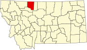 | |
| Towns | ||
| CDPs |
| |
| Other communities | ||
| ||
This Toole County, Montana state location article is a stub. You can help Wikipedia by expanding it. |
Текст в блоке "Читать" взят с сайта "Википедия" и доступен по лицензии Creative Commons Attribution-ShareAlike; в отдельных случаях могут действовать дополнительные условия.
Другой контент может иметь иную лицензию. Перед использованием материалов сайта WikiSort.org внимательно изучите правила лицензирования конкретных элементов наполнения сайта.
Другой контент может иметь иную лицензию. Перед использованием материалов сайта WikiSort.org внимательно изучите правила лицензирования конкретных элементов наполнения сайта.
2019-2026
WikiSort.org - проект по пересортировке и дополнению контента Википедии
WikiSort.org - проект по пересортировке и дополнению контента Википедии