world.wikisort.org - USA
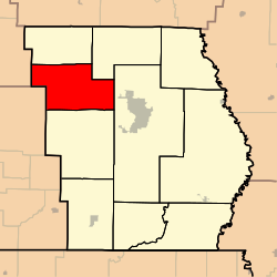
Epps Township is one of ten townships in Butler County, Missouri, USA. As of the 2010 census, its population was 3,171.
Epps Township | |
|---|---|
Township | |
 | |
| Coordinates: 36°48′38″N 090°33′07″W | |
| Country | United States |
| State | Missouri |
| County | Butler |
| Area | |
| • Total | 53.84 sq mi (139.45 km2) |
| • Land | 53.79 sq mi (139.31 km2) |
| • Water | 0.06 sq mi (0.14 km2) 0.1% |
| Elevation | 466 ft (142 m) |
| Population (2010) | |
| • Total | 3,171 |
| • Density | 48.3/sq mi (18.6/km2) |
| FIPS code | 29-22492[2] |
| GNIS feature ID | 0766353[1] |
Epps Township was established in 1850, and named after Obadiah Epps, an early settler.[3]
Geography
Epps Township covers an area of 53.84 square miles (139.4 km2) and contains no incorporated settlements. It contains three cemeteries: Houts, Kearbey (Kearbey Chapel Cemetery) and Sparkman.
The streams of Beehole Branch, Camp Branch, Crooked Branch, Goose Creek, Harmon Branch, Hurricane Creek, Procter Branch and Ten Mile Creek run through this township.
References
- U.S. Geological Survey Geographic Names Information System: Epps Township, Butler County, Missouri
- "U.S. Census website". United States Census Bureau. Retrieved 2008-01-31.
- "Butler County Place Names, 1928–1945 (archived)". The State Historical Society of Missouri. Archived from the original on 24 June 2016. Retrieved 6 September 2016.
{{cite web}}: CS1 maint: bot: original URL status unknown (link)
External links
Municipalities and communities of Butler County, Missouri, United States | ||
|---|---|---|
County seat: Poplar Bluff | ||
| Cities |
|  |
| Townships |
| |
| CDPs |
| |
| Other communities | ||
| Ghost town |
| |
| Footnotes | ‡This populated place also has portions in an adjacent county or counties | |
| ||
This Butler County, Missouri state location article is a stub. You can help Wikipedia by expanding it. |
Текст в блоке "Читать" взят с сайта "Википедия" и доступен по лицензии Creative Commons Attribution-ShareAlike; в отдельных случаях могут действовать дополнительные условия.
Другой контент может иметь иную лицензию. Перед использованием материалов сайта WikiSort.org внимательно изучите правила лицензирования конкретных элементов наполнения сайта.
Другой контент может иметь иную лицензию. Перед использованием материалов сайта WikiSort.org внимательно изучите правила лицензирования конкретных элементов наполнения сайта.
2019-2026
WikiSort.org - проект по пересортировке и дополнению контента Википедии
WikiSort.org - проект по пересортировке и дополнению контента Википедии