world.wikisort.org - USA
Elba is a city in Winona County, Minnesota, United States. The population was 152 at the 2010 census.[4] It is on Minnesota State Highway 74 just north of Whitewater State Park.
Elba | |
|---|---|
City | |
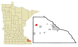 Location of Elba, Minnesota | |
| Coordinates: 44°5′33″N 92°1′5″W | |
| Country | United States |
| State | Minnesota |
| County | Winona |
| Government | |
| • Type | Mayor - Council |
| • Mayor | Jay Mollert |
| Area | |
| • Total | 1.93 sq mi (5.01 km2) |
| • Land | 1.93 sq mi (5.01 km2) |
| • Water | 0.00 sq mi (0.00 km2) |
| Elevation | 738 ft (225 m) |
| Population (2020) | |
| • Total | 129 |
| • Density | 66.70/sq mi (25.75/km2) |
| Time zone | UTC-6 (Central (CST)) |
| • Summer (DST) | UTC-5 (CDT) |
| ZIP code | 55910 |
| Area code | 507 |
| FIPS code | 27-18386[2] |
| GNIS feature ID | 0643223[3] |
History
Elba was laid out in 1856, and named after the island of Elba.[5] The city was originally built up chiefly by ethnic Germans from Luxembourg.[6] A post office was in operation at Elba from 1858 until 1965.[7]
As a result of the 2007 Midwest flooding, the town was flooded when the dikes holding back the Whitewater River failed on August 18, 2007.[8]
Geography
According to the United States Census Bureau, the city has a total area of 2.04 square miles (5.28 km2), all land.[9]
Demographics
| Historical population | |||
|---|---|---|---|
| Census | Pop. | %± | |
| 1880 | 98 | — | |
| 1900 | 198 | — | |
| 1910 | 151 | −23.7% | |
| 1920 | 172 | 13.9% | |
| 1930 | 152 | −11.6% | |
| 1940 | 159 | 4.6% | |
| 1950 | 147 | −7.5% | |
| 1960 | 152 | 3.4% | |
| 1970 | 158 | 3.9% | |
| 1980 | 198 | 25.3% | |
| 1990 | 220 | 11.1% | |
| 2000 | 214 | −2.7% | |
| 2010 | 152 | −29.0% | |
| 2020 | 129 | −15.1% | |
| U.S. Decennial Census[10] | |||
2010 census
As of the census[11] of 2010, there were 152 people, 70 households, and 44 families living in the city. The population density was 74.5 inhabitants per square mile (28.8/km2). There were 76 housing units at an average density of 37.3 per square mile (14.4/km2). The racial makeup of the city was 98.7% White and 1.3% from other races. Hispanic or Latino of any race were 3.3% of the population.
There were 70 households, of which 25.7% had children under the age of 18 living with them, 45.7% were married couples living together, 11.4% had a female householder with no husband present, 5.7% had a male householder with no wife present, and 37.1% were non-families. 32.9% of all households were made up of individuals, and 11.5% had someone living alone who was 65 years of age or older. The average household size was 2.17 and the average family size was 2.64.
The median age in the city was 45.3 years. 19.1% of residents were under the age of 18; 8.4% were between the ages of 18 and 24; 21.7% were from 25 to 44; 34.3% were from 45 to 64; and 16.4% were 65 years of age or older. The gender makeup of the city was 57.9% male and 42.1% female.
2000 census
As of the census[2] of 2000, there were 214 people, 72 households, and 58 families living in the city. The population density was 105.0 people per square mile (40.5/km2). There were 77 housing units at an average density of 37.8 per square mile (14.6/km2). The racial makeup of the city was 100.00% White. Hispanic or Latino of any race were 1.40% of the population.
There were 72 households, out of which 51.4% had children under the age of 18 living with them, 58.3% were married couples living together, 6.9% had a female householder with no husband present, and 19.4% were non-families. 16.7% of all households were made up of individuals, and 12.5% had someone living alone who was 65 years of age or older. The average household size was 2.97 and the average family size was 3.28.
In the city, the population was spread out, with 35.5% under the age of 18, 7.0% from 18 to 24, 30.4% from 25 to 44, 18.2% from 45 to 64, and 8.9% who were 65 years of age or older. The median age was 31 years. For every 100 females, there were 107.8 males. For every 100 females age 18 and over, there were 102.9 males.
The median income for a household in the city was $38,750, and the median income for a family was $41,042. Males had a median income of $30,156 versus $22,500 for females. The per capita income for the city was $14,398. About 3.5% of families and 6.2% of the population were below the poverty line, including 5.9% of those under the age of eighteen and 8.7% of those 65 or over.
Education
Elba is part of the St. Charles School District.
References
- "2020 U.S. Gazetteer Files". United States Census Bureau. Retrieved July 24, 2022.
- "U.S. Census website". United States Census Bureau. Retrieved 2008-01-31.
- "US Board on Geographic Names". United States Geological Survey. 2007-10-25. Retrieved 2008-01-31.
- "2010 Census Redistricting Data (Public Law 94-171) Summary File". American FactFinder. United States Census Bureau. Retrieved 27 April 2011.[dead link]
- Upham, Warren (1920). Minnesota Geographic Names: Their Origin and Historic Significance. Minnesota Historical Society. p. 582.
- Paprock, John-Brian; Paprock, Teresa Peneguy (2004). Sacred Sites of Minnesota. Trails Books guide. Black Earth, Wisconsin: Trails Books. p. 57. ISBN 1931599262. OCLC 54951777. Retrieved December 31, 2012.
- "Winona County". Jim Forte Postal History. Retrieved 15 August 2015.
- Steil, Mark (2007-08-22). "The town of Elba mucks out". Minnesota Public Radio. Retrieved 2007-08-24.
- "US Gazetteer files 2010". United States Census Bureau. Archived from the original on 2012-01-25. Retrieved 2012-11-13.
- "Census of Population and Housing". Census.gov. Retrieved June 4, 2015.
- "U.S. Census website". United States Census Bureau. Retrieved 2012-11-13.
External links
Municipalities and communities of Winona County, Minnesota, United States | ||
|---|---|---|
County seat: Winona | ||
| Cities |  | |
| Townships | ||
| CDPs | ||
| Other communities | ||
| Ghost towns |
| |
| Footnotes | ‡This populated place also has portions in an adjacent county or counties | |
| ||
На других языках
- [en] Elba, Minnesota
[ru] Элба (город, Миннесота)
Элба (англ. Elba) — город в округе Уинона, штат Миннесота, США. На площади 5,3 км² (5,3 км² — суша, водоёмов нет), согласно переписи 2002 года, проживают 214 человек. Плотность населения составляет 40,5 чел./км².Другой контент может иметь иную лицензию. Перед использованием материалов сайта WikiSort.org внимательно изучите правила лицензирования конкретных элементов наполнения сайта.
WikiSort.org - проект по пересортировке и дополнению контента Википедии