world.wikisort.org - USA
Ectonville is an unincorporated community in Clay County, Missouri, United States. It is part of the Kansas City metropolitan area.
Ectonville, Missouri | |
|---|---|
Unincorporated community | |
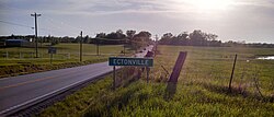
 Entrance sign to the community | |
 Ectonville Location in the state of Missouri | |
| Coordinates: 39°22′04″N 94°28′41″W | |
| Country | United States |
| State | Missouri |
| County | Clay |
| Elevation | 1,020 ft (310 m) |
| Time zone | UTC-6 (Central (CST)) |
| • Summer (DST) | UTC-5 (CDT) |
| ZIP code | 64167 |
| Area code(s) | 816 |
| GNIS feature ID | 717394[1] |
Ectonville is located at 39°22′04″N 94°28′41″W (39.367779, -94.478007).[1] Its elevation is 1,020 feet (310 m).
The community was named after Dillie Ecton, a local merchant in the 1930s.[2]
References
- U.S. Geological Survey Geographic Names Information System: Ectonville, Missouri. Retrieved on 23 August 2008.
- "Clay County Place Names, 1928–1945 (archived)". The State Historical Society of Missouri. Archived from the original on 24 June 2016. Retrieved 19 September 2016.
{{cite web}}: CS1 maint: bot: original URL status unknown (link)
External links
- Google satellite map of Ectonville at Maplandia.com
Текст в блоке "Читать" взят с сайта "Википедия" и доступен по лицензии Creative Commons Attribution-ShareAlike; в отдельных случаях могут действовать дополнительные условия.
Другой контент может иметь иную лицензию. Перед использованием материалов сайта WikiSort.org внимательно изучите правила лицензирования конкретных элементов наполнения сайта.
Другой контент может иметь иную лицензию. Перед использованием материалов сайта WikiSort.org внимательно изучите правила лицензирования конкретных элементов наполнения сайта.
2019-2025
WikiSort.org - проект по пересортировке и дополнению контента Википедии
WikiSort.org - проект по пересортировке и дополнению контента Википедии
