world.wikisort.org - USA
East Verde Estates is a census-designated place in Gila County in the U.S. state of Arizona. East Verde Estates is located approximately six miles north of the town of Payson, off Arizona State Route 87. The population as of the 2010 U.S. Census was 170.[2]
East Verde Estates, Arizona | |
|---|---|
Census-designated place | |
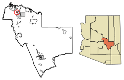 Location of East Verde Estates in Gila County, Arizona. | |
 East Verde Estates  East Verde Estates | |
| Coordinates: 34°17′54″N 111°21′52″W | |
| Country | United States |
| State | Arizona |
| County | Gila |
| Area | |
| • Total | 2.50 sq mi (6.48 km2) |
| • Land | 2.50 sq mi (6.48 km2) |
| • Water | 0.00 sq mi (0.00 km2) |
| Elevation | 4,613 ft (1,406 m) |
| Population (2020) | |
| • Total | 151 |
| • Density | 60.30/sq mi (23.29/km2) |
| Time zone | UTC-7 (Mountain (MST)) |
| Area code(s) | 928 |
| GNIS feature ID | 2582778 |
Geography
East Verde Estates is located at 34.298272°N 111.364552°W.
According to the U.S. Census Bureau, the community has an area of 2.504 square miles (6.49 km2), all land.[3]
Demographics
| Historical population | |||
|---|---|---|---|
| Census | Pop. | %± | |
| 2020 | 151 | — | |
| U.S. Decennial Census[4] | |||
References
- "2020 U.S. Gazetteer Files". United States Census Bureau. Retrieved October 29, 2021.
- "2010 Census Interactive Population Search". census.gov. Archived from the original on 2014-04-17. Retrieved 2014-04-17.
- "2010 Census Gazetteer Files: Places - Arizona". U.S. Census Bureau. Archived from the original on September 6, 2013. Retrieved July 16, 2014.
- "Census of Population and Housing". Census.gov. Retrieved June 4, 2016.
Municipalities and communities of Gila County, Arizona, United States | ||
|---|---|---|
County seat: Globe | ||
| City |
|  |
| Towns |
| |
| CDPs |
| |
| Populated places |
| |
| Indian reservations |
| |
| Ghost towns |
| |
| Footnotes | ‡This populated place also has portions in an adjacent county or counties | |
| ||
Текст в блоке "Читать" взят с сайта "Википедия" и доступен по лицензии Creative Commons Attribution-ShareAlike; в отдельных случаях могут действовать дополнительные условия.
Другой контент может иметь иную лицензию. Перед использованием материалов сайта WikiSort.org внимательно изучите правила лицензирования конкретных элементов наполнения сайта.
Другой контент может иметь иную лицензию. Перед использованием материалов сайта WikiSort.org внимательно изучите правила лицензирования конкретных элементов наполнения сайта.
2019-2025
WikiSort.org - проект по пересортировке и дополнению контента Википедии
WikiSort.org - проект по пересортировке и дополнению контента Википедии