world.wikisort.org - USA
Eagle Township is a township in Barber County, Kansas, USA. As of the 2000 census, its population was 42.
Eagle Township | |
|---|---|
Township | |
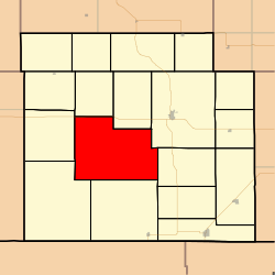 Location in Barber County | |
| Coordinates: 37°12′20″N 098°41′16″W | |
| Country | United States |
| State | Kansas |
| County | Barber |
| Area | |
| • Total | 111.87 sq mi (289.73 km2) |
| • Land | 111.82 sq mi (289.62 km2) |
| • Water | 0.04 sq mi (0.11 km2) 0.04% |
| Elevation | 1,703 ft (519 m) |
| Population (2000) | |
| • Total | 42 |
| • Density | 0.4/sq mi (0.1/km2) |
| GNIS feature ID | 0470475 |
Geography
Eagle Township covers an area of 111.87 square miles (289.7 km2) and contains no incorporated settlements. According to the USGS, it contains one cemetery, Lodi.
The streams of East Cedar Creek, Pump Creek, Salt Fork Arkansas River, Salty Creek and West Cedar Creek run through this township.
References
External links
- Lodi, Eagle Township, Barber County, Kansas
- The Oak Creek Ranch History, photographs, geology, maps, wildlife and flowers of a ranch in Eagle Township, Barber County, Kansas.
- US-Counties.com
- City-Data.com
Municipalities and communities of Barber County, Kansas, United States | ||
|---|---|---|
County seat: Medicine Lodge | ||
| Cities |  | |
| Unincorporated communities |
| |
| Townships | ||
| Footnotes | †This community is designated a Census-Designated Place (CDP) by the United States Census Bureau. | |
| ||
Текст в блоке "Читать" взят с сайта "Википедия" и доступен по лицензии Creative Commons Attribution-ShareAlike; в отдельных случаях могут действовать дополнительные условия.
Другой контент может иметь иную лицензию. Перед использованием материалов сайта WikiSort.org внимательно изучите правила лицензирования конкретных элементов наполнения сайта.
Другой контент может иметь иную лицензию. Перед использованием материалов сайта WikiSort.org внимательно изучите правила лицензирования конкретных элементов наполнения сайта.
2019-2025
WikiSort.org - проект по пересортировке и дополнению контента Википедии
WikiSort.org - проект по пересортировке и дополнению контента Википедии