world.wikisort.org - USA
Dunleith Township is one of twenty-three townships in Jo Daviess County, Illinois, USA. As of the 2010 census, its population was 3,820 and it contained 1,713 housing units.[2] It was formed from Menominee Township on March 2, 1865.
Dunleith Township | |
|---|---|
Township | |
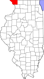
 Location in Jo Daviess County | |
 Jo Daviess County's location in Illinois | |
| Coordinates: 42°28′42″N 90°36′48″W | |
| Country | United States |
| State | Illinois |
| County | Jo Daviess |
| Established | March 2, 1865 |
| Government | |
| • Supervisor | Vincent Hasken |
| Area | |
| • Total | 11.75 sq mi (30.4 km2) |
| • Land | 9.45 sq mi (24.5 km2) |
| • Water | 2.29 sq mi (5.9 km2) 19.49% |
| Elevation | 732 ft (223 m) |
| Population (2010) | |
| • Estimate (2016)[1] | 3,672 |
| • Density | 404.2/sq mi (156.1/km2) |
| Time zone | UTC-6 (CST) |
| • Summer (DST) | UTC-5 (CDT) |
| ZIP codes | 61025 |
| FIPS code | 17-085-21202 |
Geography
Dunleith Township is in the very northwest corner of Illinois, abutting Wisconsin to the north and Iowa to the west across the Mississippi River.
According to the 2010 census, the township has a total area of 11.75 square miles (30.4 km2), of which 9.45 square miles (24.5 km2) (or 80.43%) is land and 2.29 square miles (5.9 km2) (or 19.49%) is water.[2]
Dunleith is Townships 28 (part) and 29 North, Range 2 (part) West of the Fourth Principal Meridian.
Cities, towns, villages
Major highways
 U.S. Route 20 - east towards Galena and west over the Mississippi River on the Julien Dubuque Bridge to Dubuque, Iowa.
 Illinois Route 35 - a northeast-southwest route from Jct US 20 in East Dubuque to the Wisconsin state line, continuing as
  .
.
Rivers
Lakes
- Frentress Lake.
- Round Lake.
- Switzer Lake.
Demographics
| Historical population | |||
|---|---|---|---|
| Census | Pop. | %± | |
| 2016 (est.) | 3,672 | [1] | |
| U.S. Decennial Census[3] | |||
School districts
- East Dubuque Community Unit School District 119.
Political districts
- Illinois' 16th congressional district.
- State House District 89.
- State Senate District 45.
References
- "Dunleith Township, Jo Daviess County, Illinois". Geographic Names Information System. United States Geological Survey, United States Department of the Interior. Retrieved 2010-01-17.
- United States Census Bureau 2007 TIGER/Line Shapefiles.
- United States National Atlas.
- "Population and Housing Unit Estimates". Retrieved June 9, 2017.
- "Population, Housing Units, Area, and Density: 2010 - County -- County Subdivision and Place -- 2010 Census Summary File 1". United States Census. Archived from the original on 2020-02-12. Retrieved 2013-05-28.
- "Census of Population and Housing". Census.gov. Retrieved June 4, 2016.
External links
- Jo Daviess County official site.
- City-Data.com.
- Illinois State Archives.
- Township Officials of Illinois.
Places adjacent to Dunleith Township, Jo Daviess County, Illinois | ||||||||||||||||
|---|---|---|---|---|---|---|---|---|---|---|---|---|---|---|---|---|
| ||||||||||||||||
Municipalities and communities of Jo Daviess County, Illinois, United States | ||
|---|---|---|
County seat: Galena | ||
| Cities |
|  |
| Villages | ||
| Townships | ||
| CDPs | ||
| Other unincorporated communities | ||
| Ghost town |
| |
| ||
На других языках
[de] Dunleith Township
Die Dunleith Township ist eine von 23 Townships im Jo Daviess County im äußersten Nordwesten des US-amerikanischen Bundesstaates Illinois.- [en] Dunleith Township, Jo Daviess County, Illinois
Текст в блоке "Читать" взят с сайта "Википедия" и доступен по лицензии Creative Commons Attribution-ShareAlike; в отдельных случаях могут действовать дополнительные условия.
Другой контент может иметь иную лицензию. Перед использованием материалов сайта WikiSort.org внимательно изучите правила лицензирования конкретных элементов наполнения сайта.
Другой контент может иметь иную лицензию. Перед использованием материалов сайта WikiSort.org внимательно изучите правила лицензирования конкретных элементов наполнения сайта.
2019-2025
WikiSort.org - проект по пересортировке и дополнению контента Википедии
WikiSort.org - проект по пересортировке и дополнению контента Википедии