world.wikisort.org - USA
Dover is a city in Tuscarawas County, Ohio, United States, located approximately 82 miles (132 km) south of Cleveland and borders the county seat of New Philadelphia. The population of Dover was 13,112 at the 2020 census.
Dover, Ohio | |
|---|---|
City | |
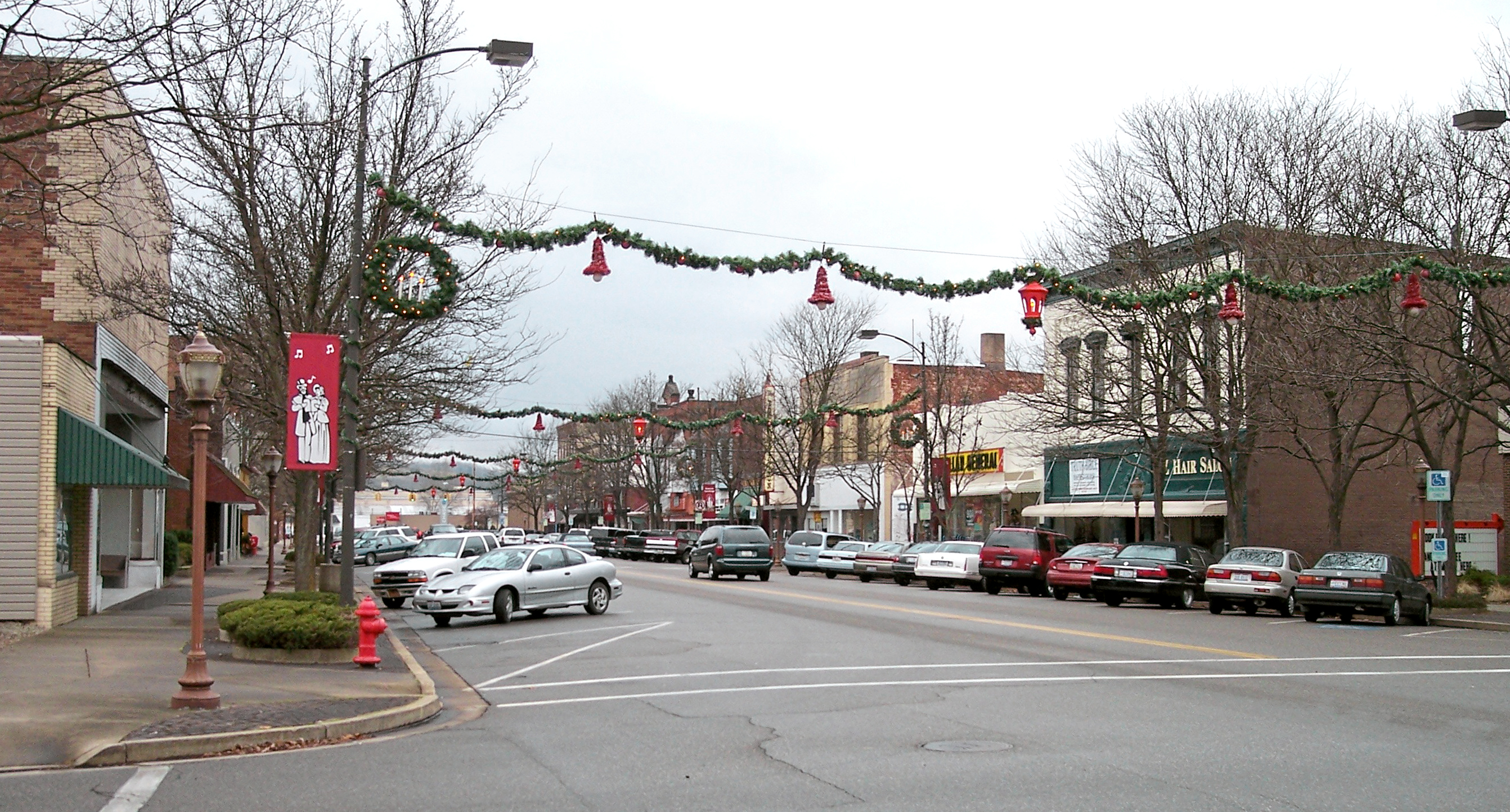 West Third Street in downtown Dover in 2006 | |
 Location of Dover, Ohio | |
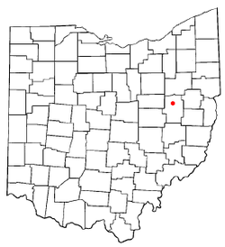
 Location of Dover in Tuscarawas County | |
| Coordinates: 40°31′36″N 81°28′40″W | |
| Country | United States |
| State | Ohio |
| County | Tuscarawas |
| Government | |
| • Mayor | Shane Gunnoe |
| Area | |
| • Total | 5.90 sq mi (15.28 km2) |
| • Land | 5.79 sq mi (15.01 km2) |
| • Water | 0.10 sq mi (0.27 km2) |
| Elevation | 879 ft (268 m) |
| Population (2020) | |
| • Total | 13,112 |
| • Density | 2,263.03/sq mi (873.75/km2) |
| Time zone | UTC-5 (Eastern (EST)) |
| • Summer (DST) | UTC-4 (EDT) |
| ZIP code | 44622 |
| Area code | 330 |
| FIPS code | 39-22456[3] |
| GNIS feature ID | 1039763[2] |
| Website | http://www.doverohio.com/ |
History
Originally named Canal Dover due to its location and origins along the Ohio and Erie Canal, the land was platted in 1807, with Christian Deardorff and Jesse Slingluff recognized as the founders.[4] Beginning in 1815, the post office first began operation.[5] Canal Dover incorporated as a village in 1842 and became a city under the Ohio municipal code of 1903.[6] On February 12, 1916, the city officially changed its name to Dover.[7]
Geography
Dover is located at 40°31′36″N 81°28′40″W (40.526545, -81.477769),[8] along the Tuscarawas River, near the mouth of Sugar Creek.[9]
According to the United States Census Bureau, the city has a total area of 5.79 square miles (15.00 km2), of which 5.69 square miles (14.74 km2) is land and 0.10 square miles (0.26 km2) is water.[10]
Demographics
| Historical population | |||
|---|---|---|---|
| Census | Pop. | %± | |
| 1840 | 598 | — | |
| 1860 | 1,343 | — | |
| 1870 | 1,593 | 18.6% | |
| 1880 | 2,208 | 38.6% | |
| 1890 | 3,470 | 57.2% | |
| 1900 | 5,422 | 56.3% | |
| 1910 | 6,621 | 22.1% | |
| 1920 | 8,101 | 22.4% | |
| 1930 | 9,716 | 19.9% | |
| 1940 | 9,691 | −0.3% | |
| 1950 | 9,852 | 1.7% | |
| 1960 | 11,300 | 14.7% | |
| 1970 | 11,516 | 1.9% | |
| 1980 | 11,500 | −0.1% | |
| 1990 | 11,329 | −1.5% | |
| 2000 | 12,210 | 7.8% | |
| 2010 | 12,826 | 5.0% | |
| 2020 | 13,112 | 2.2% | |
| Sources:[3][11][12][13] | |||
2010 census
As of the census[14] of 2010, there were 12,826 people, 5,181 households, and 3,297 families living in the city. The population density was 2,254.1 inhabitants per square mile (870.3/km2). There were 5,578 housing units at an average density of 980.3 per square mile (378.5/km2). The racial makeup of the city was 94.1% White, 1.1% African American, 0.6% Native American, 0.5% Asian, 0.7% Pacific Islander, 1.7% from other races, and 1.4% from two or more races. Hispanic or Latino of any race were 4.1% of the population.
There were 5,181 households, of which 28.5% had children under the age of 18 living with them, 49.7% were married couples living together, 9.8% had a female householder with no husband present, 4.1% had a male householder with no wife present, and 36.4% were non-families. 31.6% of all households were made up of individuals, and 15.6% had someone living alone who was 65 years of age or older. The average household size was 2.37 and the average family size was 2.96.
The median age in the city was 42.9 years. 22.3% of residents were under the age of 18; 7.3% were between the ages of 18 and 24; 22.9% were from 25 to 44; 25.6% were from 45 to 64; and 22% were 65 years of age or older. The gender makeup of the city was 47.4% male and 52.6% female.
2000 census
As of the census[3] of 2000, there were 12,210 people, 4,996 households, and 3,362 families living in the city. The population density was 2,319.6 people per square mile (896.3/km2). There were 5,233 housing units at an average density of 994.2 per square mile (384.1/km2). The racial makeup of the city was 97.09% White, 1.27% African American, 0.25% Native American, 0.51% Asian, 0.02% Pacific Islander, 0.20% from other races, and 0.66% from two or more races. Hispanic or Latino of any race were 0.60% of the population.
There were 4,996 households, out of which 30.2% had children under the age of 18 living with them, 54.4% were married couples living together, 10.0% had a female householder with no husband present, and 32.7% were non-families. 28.8% of all households were made up of individuals, and 14.9% had someone living alone who was 65 years of age or older. The average household size was 2.39 and the average family size was 2.94.
In the city, the population was spread out, with 24.1% under the age of 18, 6.7% from 18 to 24, 26.8% from 25 to 44, 22.5% from 45 to 64, and 19.9% who were 65 years of age or older. The median age was 40 years. For every 100 females, there were 86.9 males. For every 100 females age 18 and over, there were 83.1 males.
The median income for a household in the city was $36,665, and the median income for a family was $44,604. Males had a median income of $34,579 versus $22,397 for females. The per capita income for the city was $18,928. About 7.5% of families and 9.2% of the population were below the poverty line, including 11.1% of those under age 18 and 9.7% of those age 65 or over.
Arts and culture
Dover is adjacent to New Philadelphia, the county seat of Tuscarawas County, with the two cities considered twin cities. Each year, the "Crimson Tornadoes" of Dover High School play the rival "Quakers" of New Philadelphia in a football game that has been played annually for more than a century, and is the fourth longest-running football rivalry in the state of Ohio.[15][16]
Notable people
- Hunter Armstrong, Olympic swimmer, Men's 4 × 100 Gold medal winner at Tokyo 2020
- Elwyn Berlekamp, mathematician
- James R. Black, actor and former National Football League player for the Cleveland Browns
- Frank Ellwood, former head football coach of Marshall University and Georgia Southern University
- Percival "Perci" Garner, III, Major League Baseball player for the Cleveland Indians (2016)[17]
- Vic Gilliam, member of the Oregon House of Representatives and actor
- Ernie Godfrey, college football coach and College Football Hall of Fame inductee
- Theophil Hildebrandt, mathematician
- Joseph C. Hisrich, educator and member of the Wisconsin State Assembly[18]
- Monty Hunter, former National Football League player for the Dallas Cowboys and St. Louis Cardinals
- Frank "Doc" Kelker, college football All-American
- Al Landis, member of the Ohio House of Representatives
- Al Mays, 19th-century Major League Baseball pitcher
- Ray Mears, college basketball coach at the University of Tennessee
- Elliott Nugent, playwright, producer, and actor
- Bob Peterson, animator, screenwriter, and director at Pixar
- William Quantrill, guerrilla fighter, American Civil War
- Trevor J. Rees, former Kent State Golden Flashes head football coach and athletic director
- Allan Sayre, former member of the Ohio House of Representatives
- Mark Dean Schwab, child rapist and murderer
- Zack Space, former member of the United States House of Representatives
- Herald F. Stout, admiral in the United States Navy during World War II and namesake of the USS Stout.
- Al Veigel, former Major League Baseball player for the Boston Bees during the 1939 season
- Stan White, former National Football League player for the Baltimore Colts and Detroit Lions.
- Johnny Wilson, former National Football League player for the Cleveland Rams
References
- "ArcGIS REST Services Directory". United States Census Bureau. Retrieved September 20, 2022.
- "US Board on Geographic Names". United States Geological Survey. 2007-10-25. Retrieved 2008-01-31.
- "U.S. Census website". United States Census Bureau. Retrieved 2008-01-31.
- Overman, William Daniel (1958). Ohio Town Names. Akron, OH: Atlantic Press. p. 38.
- "Post offices". Jim Forte Postal History. Archived from the original on 13 October 2015. Retrieved 9 June 2016.
- Chisholm, Hugh, ed. (1911). . Encyclopædia Britannica. Vol. 5 (11th ed.). Cambridge University Press. p. 171.
- "Postmaster Finder - Who We Are - USPS".
- "US Gazetteer files: 2010, 2000, and 1990". United States Census Bureau. 2011-02-12. Retrieved 2011-04-23.
- DeLorme (1991). Ohio Atlas & Gazetteer. Yarmouth, Maine: DeLorme. ISBN 0-89933-233-1.
- "US Gazetteer files 2010". United States Census Bureau. Archived from the original on 2012-07-02. Retrieved 2013-01-06.
- "Number of Inhabitants: Ohio" (PDF). 18th Census of the United States. U.S. Census Bureau. 1960. Retrieved 24 April 2020.
- "Ohio: Population and Housing Unit Counts" (PDF). U.S. Census Bureau. Retrieved 22 November 2013.
- "U.S. Census website". United States Census Bureau. Retrieved 2021-09-06.
- "U.S. Census website". United States Census Bureau. Retrieved 2013-01-06.
- "Dover, New Philadelphia fans prepare for big game during Spirit Week". Retrieved 22 March 2016.
- "The Tuscarawas County Italian-American festival". Archived from the original on 14 February 2015. Retrieved 13 February 2015.
- Meisel, Zack (September 2016). "Cleveland Indians rookie reliever Perci Garner 'is already leading the American League in smiles'". Cleveland.com. Retrieved 2016-09-01.
- 'Wisconsin Blue Book 1991,' Biographical Sketch of Joseph C. Hisrich, pg. 83
External links
- City of Dover
- Tuscarawas County History
- Northeast Ohio Travel - History of Dover
- Dover Public Library
Municipalities and communities of Tuscarawas County, Ohio, United States | ||
|---|---|---|
County seat: New Philadelphia | ||
| Cities |  | |
| Villages | ||
| Townships | ||
| CDPs |
| |
| Unincorporated communities |
| |
| Ghost town | ||
| Footnotes | ‡This populated place also has portions in an adjacent county or counties | |
| ||
Authority control | |
|---|---|
| General | |
| National libraries | |
| Other |
|
На других языках
[de] Dover (Ohio)
Dover ist eine Stadt im Tuscarawas County im US-Bundesstaat Ohio mit (2000) 12.210 Einwohnern.- [en] Dover, Ohio
Другой контент может иметь иную лицензию. Перед использованием материалов сайта WikiSort.org внимательно изучите правила лицензирования конкретных элементов наполнения сайта.
WikiSort.org - проект по пересортировке и дополнению контента Википедии