world.wikisort.org - USA
Dogtown is a ghost town in Lafayette County, Mississippi, United States, located on Highway 334, 17.6 miles (28.3 km) southeast of Oxford. At one time it was the location of Dogtown School.[2]
Dogtown, Mississippi | |
|---|---|
Ghost town | |
 | |
 Dogtown  Dogtown | |
| Coordinates: 34°15′53″N 89°17′09″W | |
| Country | United States |
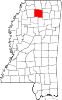
| State | Mississippi |
| County | Lafayette |
| Elevation | 423 ft (129 m) |
| Time zone | UTC-6 (Central (CST)) |
| • Summer (DST) | UTC-5 (CDT) |
| Area code(s) | 662 |
| GNIS feature ID | 693095[1] |
All that remains of Dogtown is the abandoned White's Grocery.[3]
References
- "Dogtown". Geographic Names Information System. United States Geological Survey.
- "Dogtown School (historical)". Geographic Names Information System. United States Geological Survey.
- "The Places I Live: Mississippi". Betty Press. Retrieved October 11, 2016.
Municipalities and communities of Lafayette County, Mississippi, United States | ||
|---|---|---|
County seat: Oxford | ||
| City |
|  |
| Towns |
| |
| CDPs |
| |
| Other communities |
| |
| Ghost town | ||
| ||
This Lafayette County, Mississippi state location article is a stub. You can help Wikipedia by expanding it. |
Текст в блоке "Читать" взят с сайта "Википедия" и доступен по лицензии Creative Commons Attribution-ShareAlike; в отдельных случаях могут действовать дополнительные условия.
Другой контент может иметь иную лицензию. Перед использованием материалов сайта WikiSort.org внимательно изучите правила лицензирования конкретных элементов наполнения сайта.
Другой контент может иметь иную лицензию. Перед использованием материалов сайта WikiSort.org внимательно изучите правила лицензирования конкретных элементов наполнения сайта.
2019-2026
WikiSort.org - проект по пересортировке и дополнению контента Википедии
WikiSort.org - проект по пересортировке и дополнению контента Википедии