world.wikisort.org - USA
Devil Fork was an unincorporated community located in Elliott County, Kentucky, United States.
Devil Fork, Kentucky | |
|---|---|
Unincorporated community | |
 Devil Fork Location within the state of Kentucky  Devil Fork Devil Fork (the United States) | |
| Coordinates: 38°5′12″N 83°13′40″W | |
| Country | United States |
| State | Kentucky |
| County | Elliott |
| Elevation | 968 ft (295 m) |
| Time zone | UTC-5 (Eastern (EST)) |
| • Summer (DST) | UTC-4 (EDT) |
| GNIS feature ID | 2337149[1] |
References
Municipalities and communities of Elliott County, Kentucky, United States | ||
|---|---|---|
County seat: Sandy Hook | ||
| City | 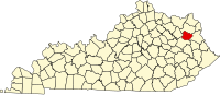 | |
| Unincorporated communities | ||
| ||
This Elliott County, Kentucky state location article is a stub. You can help Wikipedia by expanding it. |
Текст в блоке "Читать" взят с сайта "Википедия" и доступен по лицензии Creative Commons Attribution-ShareAlike; в отдельных случаях могут действовать дополнительные условия.
Другой контент может иметь иную лицензию. Перед использованием материалов сайта WikiSort.org внимательно изучите правила лицензирования конкретных элементов наполнения сайта.
Другой контент может иметь иную лицензию. Перед использованием материалов сайта WikiSort.org внимательно изучите правила лицензирования конкретных элементов наполнения сайта.
2019-2026
WikiSort.org - проект по пересортировке и дополнению контента Википедии
WikiSort.org - проект по пересортировке и дополнению контента Википедии