world.wikisort.org - USA
Des Allemands is an unincorporated community and census-designated place (CDP) in Lafourche and St. Charles parishes in the southeastern part of the U.S. state of Louisiana. The population was 2,179 at the 2020 census.[2] The town, known as the "Catfish Capital of the Universe",[3] is along the Bayou des Allemands, which is the boundary of Lafourche and St. Charles parishes. Lac des Allemands is located northwest of the town. The ZIP code for Des Allemands is 70030.
Des Allemands, Louisiana
"The Germans" | |
|---|---|
Census-designated place | |
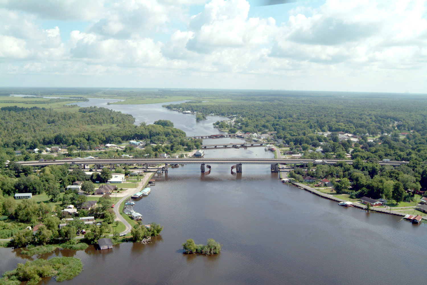 Des Allemands on the Bayou des Allemands. View to the north. | |
| Nickname: "Catfish Capital of the Universe" | |
 Des Allemands Location in Louisiana  Des Allemands Location in the United States | |
| Coordinates: 29°49′32″N 90°28′09″W | |
| Country | United States |
| State | Louisiana |
| Parishes | Lafourche, St. Charles |
| Area | |
| • Total | 12.23 sq mi (31.69 km2) |
| • Land | 9.95 sq mi (25.77 km2) |
| • Water | 2.29 sq mi (5.92 km2) |
| Elevation | 3 ft (0.9 m) |
| Population (2020) | |
| • Total | 2,179 |
| • Density | 219.02/sq mi (84.56/km2) |
| Time zone | UTC-6 (CST) |
| • Summer (DST) | UTC-5 (CDT) |
| ZIP Code | 70030 |
| Area code | 985 |
| FIPS code | 22-20680 |
The St. Charles Parish portion of Des Allemands is part of the New Orleans metropolitan statistical area, while the Lafourche Parish portion is part of the Houma–Bayou Cane–Thibodaux metropolitan statistical area.
History


In 1721, John Law and the Company of the Indies settled Germans along the Mississippi River, north of Ouachas Lake. The area of the Germans was called les Allemands (the Germans) or Karlstein. The German Coast was in present-day St. Charles & St. John the Baptist Parishes.[4] Des Allemands means "of the Germans" in French.
The German Louisiana colony was originally up the Mississippi River at the Arkansas Post. But they experienced hostility from the Native Americans in that area, and moved to a location much closer to the colonial capital of New Orleans.
Geography
Des Allemands is located in southern St. Charles Parish and northeastern Lafourche Parish at 29°49′32″N 90°28′9″W (29.825570, -90.469163).[5] It is bordered to the north by the Paradis CDP and to the southeast by the Bayou Gauche CDP.
U.S. Route 90 crosses Bayou des Allemands at this point; the four-lane highway leads northeast 34 miles (55 km) to New Orleans and west 51 miles (82 km) to Morgan City. Bayou Des Allemands runs northwest 5 miles (8 km) to Lac des Allemands and southeast 13 miles (21 km) to Lake Salvador.
According to the United States Census Bureau, the Des Allemands CDP has a total area of 12.2 square miles (31.7 km2), of which 10.0 square miles (25.8 km2) are land and 2.3 square miles (5.9 km2), or 18.68%, are water.[6]
Demographics
| Historical population | |||
|---|---|---|---|
| Census | Pop. | %± | |
| 2020 | 2,179 | — | |
| U.S. Decennial Census[7] | |||
2020 census
| Race | Number | Percentage |
|---|---|---|
| White (non-Hispanic) | 1,700 | 78.02% |
| Black or African American (non-Hispanic) | 296 | 13.58% |
| Native American | 23 | 1.06% |
| Asian | 4 | 0.18% |
| Other/Mixed | 84 | 3.85% |
| Hispanic or Latino | 72 | 3.3% |
As of the 2020 United States census, there were 2,179 people, 670 households, and 468 families residing in the CDP.
Education
St. Charles Parish Public School System serves parts of Des Allemands east of Bayou Des Allemands. Allemands Elementary School in Des Allemands serves grades PK-2, while R.J. Vial Elementary School in Paradis serves grades 3–5; Vial opened in 1975.[9] J. B. Martin Middle School in Paradis serves grades 6–8,[10] and Hahnville High School in Boutte serves 9–12.[11]
Residents of Des Allemands west of Bayou Des Allemands attend Lafourche Parish Public Schools. People in the Bayou Des Allemands area of Lafourche Parish are zoned to Raceland Lower Elementary School, Raceland Upper Elementary School, Raceland Middle School (all in Raceland), and Central Lafourche High School in Mathews.[12][13]
Festivals
- Louisiana Catfish Festival on the third weekend in June
- Small parade in conjunction with Mardi Gras season
See also
- German Coast
- Live and Let Die: The motor boat chase scene in Roger Moore's debut James Bond movie was filmed in Bayou Des Allemands.
References
- "2020 U.S. Gazetteer Files". United States Census Bureau. Retrieved March 20, 2022.
- "2020 Race and Population Totals". United States Census Bureau. Archived from the original on 2021-10-25. Retrieved 2021-10-25.
- "National Catfish Day is every day in the 'Catfish Capital of the Universe'". WGNO. 2018-06-25. Retrieved 2021-10-25.
- John Law, acadian-cajun.com
- "US Gazetteer files: 2010, 2000, and 1990". United States Census Bureau. 2011-02-12. Retrieved 2011-04-23.
- "U.S. Gazetteer Files: 2019: Places: Louisiana". U.S. Census Bureau Geography Division. Retrieved February 21, 2020.
- "Census of Population and Housing". Census.gov. Retrieved June 4, 2016.
- "Explore Census Data". data.census.gov. Retrieved 2021-12-28.
- Home. R.J. Vial Elementary School. Retrieved on December 3, 2016. "R. J. Vial Elementary School, home of the Jaguars, was established in 1975 and has served the communities of Paradis, Bayou Gauche, Des Allemands, and Boutte for more than 40 years."
- "About Our School." J. B. Martin Middle School. Retrieved on December 3, 2016. "J. B. Martin Middle School is located on South Street in Paradis and services the west bank areas of Paradis, Des Allemands (Bayou Gauche), Boutte, and Luling (Mimosa/Willowdale)."
- "Hahnville High School" (Archive). AdvancED. p. 4/9. Retrieved on December 3, 2016. "Hahnville High School services all students on the west bank of the Mississippi River in St. Charles Parish, including the communities of Ama, Boutte, Hahnville, Luling, Paradis, Des Allemands and Killona."
- "SCHOOL ATTENDANCE BOUNDARIES." Lafourche Parish Public Schools. Retrieved on December 2, 2016. See text descriptions of boundaries. The page states: "Students who reside in the Des Allemands area on the west side of Bayou Des Allemands will attend Lafourche Parish schools."
- "2010 CENSUS - CENSUS BLOCK MAP (INDEX): Des Allemands CDP, LA." U.S. Census Bureau. Retrieved on November 29, 2016. Pages: 1, 2, 3.
External links
Municipalities and communities of Lafourche Parish, Louisiana, United States | ||
|---|---|---|
Parish seat: Thibodaux | ||
| City |  | |
| Towns | ||
| CDPs | ||
| Other communities |
| |
| Footnotes | ‡This populated place also has portions in an adjacent parish or parishes | |
| ||
Municipalities and communities of St. Charles Parish, Louisiana, United States | ||
|---|---|---|
Parish seat: Hahnville | ||
| CDPs |  | |
| Unincorporated areas | ||
| Ghost towns | ||
| Former populated places |
| |
| Footnotes | ‡This populated place also has portions in an adjacent parish or parishes | |
| ||
| Authority control |
|
|---|
Другой контент может иметь иную лицензию. Перед использованием материалов сайта WikiSort.org внимательно изучите правила лицензирования конкретных элементов наполнения сайта.
WikiSort.org - проект по пересортировке и дополнению контента Википедии