world.wikisort.org - USA
Delton is a census-designated place (CDP) in Barry Township in Barry County, Michigan, United States. The population was 872 at the 2010 census.[2]
Delton, Michigan | |
|---|---|
Census-designated place (CDP) & unincorporated community | |
 Delton | |
| Coordinates: 42°29′59″N 85°24′29″W | |
| Country | United States |
| State | Michigan |
| County | Barry |
| Township | Barry |
| Area | |
| • Total | 2.55 sq mi (6.61 km2) |
| • Land | 2.21 sq mi (5.74 km2) |
| • Water | 0.34 sq mi (0.87 km2) |
| Elevation | 947 ft (289 m) |
| Population (2020) | |
| • Total | 854 |
| • Density | 385.55/sq mi (148.86/km2) |
| Time zone | UTC-5 (Eastern (EST)) |
| • Summer (DST) | UTC-4 (EDT) |
| ZIP code | 49046 |
| Area code(s) | Area code 269 |
| FIPS code | 26-21560 |
| GNIS feature ID | 0624538 |
Geography
Delton is located in southwestern Barry County. It is bordered to the north by Hope Township. To the west the CDP extends slightly into Prairieville Township, Cloverdale and Cedar Creek. State highway M-43 runs through the town center, leading northeast 14 miles (23 km) to Hastings and southwest 19 miles (31 km) to downtown Kalamazoo.
According to the United States Census Bureau, the Delton CDP has a total area of 2.2 square miles (5.8 km2), of which 2.2 square miles (5.6 km2) is land and 0.077 square miles (0.2 km2), or 2.99%, is water.[2] The eastern end of Crooked Lake occupies the western part of the CDP.
Delton Kellogg High School, Middle School, and Elementary school are all located in the CDP, in the center of town.
Demographics
| Historical population | |||
|---|---|---|---|
| Census | Pop. | %± | |
| 2020 | 854 | — | |
To Know
In 1883 a railroad was created and went through Delton. In 2008 the last tracks were torn up. In 1936, Delton Kellogg Agricultural school was built, and that helped increase Delton's population. There are over 10 lakes in Delton.
Schools
- Delton Kellogg Elementary School
- Delton Kellogg Middle School
- Delton Kellogg High School
- Kidz Care Center (Not Operational)
- Early Head Start
- Ceder Creek Christian School
References
- "2020 U.S. Gazetteer Files". United States Census Bureau. Retrieved May 21, 2022.
- "Geographic Identifiers: 2010 Demographic Profile Data (G001): Delton CDP, Michigan". U.S. Census Bureau, American Factfinder. Archived from the original on February 12, 2020. Retrieved December 23, 2013.
- "Census of Population and Housing". Census.gov. Retrieved June 4, 2016.
Municipalities and communities of Barry County, Michigan, United States | ||
|---|---|---|
County seat: Hastings | ||
| City | 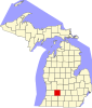 | |
| Villages | ||
| Charter townships | ||
| Civil townships | ||
| CDPs | ||
| Other communities | ||
| ||
Другой контент может иметь иную лицензию. Перед использованием материалов сайта WikiSort.org внимательно изучите правила лицензирования конкретных элементов наполнения сайта.
WikiSort.org - проект по пересортировке и дополнению контента Википедии