world.wikisort.org - USA
Decatur Township is a township in Decatur County, Iowa, USA. As of the 2000 census, its population was 425.
Decatur Township | |
|---|---|
Township | |
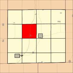 Location in Decatur County | |
| Coordinates: 40°45′59″N 93°50′13″W | |
| Country | |
| State | |
| County | Decatur |
| Area | |
| • Total | 35.77 sq mi (92.65 km2) |
| • Land | 35.64 sq mi (92.3 km2) |
| • Water | 0.14 sq mi (0.35 km2) 0.38% |
| Elevation | 1,102 ft (336 m) |
| Population (2000) | |
| • Total | 425 |
| • Density | 11.9/sq mi (4.6/km2) |
| GNIS feature ID | 0467689 |
Geography
Decatur Township covers an area of 35.77 square miles (92.65 square kilometers); of this, 0.14 square miles (0.35 square kilometers) or 0.38 percent is water. The streams of Long Creek and Marks Branch run through this township.
Cities and towns
- Decatur City
Adjacent townships
- Long Creek Township (north)
- Franklin Township (northeast)
- Center Township (east)
- Eden Township (southeast)
- Burrell Township (south)
- Bloomington Township (southwest)
- Grand River Township (west)
- Richland Township (northwest)
Cemeteries
The township contains six cemeteries: Cash, Decatur City, Palenstine, Shy, Waller and Woodmansee.
Major highways
- Interstate 35
References
External links
Municipalities and communities of Decatur County, Iowa, United States | ||
|---|---|---|
County seat: Leon | ||
| Cities |
|  |
| Townships | ||
| Unincorporated communities | ||
| ||
This article about the geography of Decatur County, Iowa is a stub. You can help Wikipedia by expanding it. |
Текст в блоке "Читать" взят с сайта "Википедия" и доступен по лицензии Creative Commons Attribution-ShareAlike; в отдельных случаях могут действовать дополнительные условия.
Другой контент может иметь иную лицензию. Перед использованием материалов сайта WikiSort.org внимательно изучите правила лицензирования конкретных элементов наполнения сайта.
Другой контент может иметь иную лицензию. Перед использованием материалов сайта WikiSort.org внимательно изучите правила лицензирования конкретных элементов наполнения сайта.
2019-2026
WikiSort.org - проект по пересортировке и дополнению контента Википедии
WikiSort.org - проект по пересортировке и дополнению контента Википедии