world.wikisort.org - USA
Cumnock, formerly known as Egypt,[1] is an unincorporated community in northwestern Lee County, North Carolina, United States. It lies on Cumnock Road, about a mile north of U.S. Route 421.
Cumnock, North Carolina | |
|---|---|
Unincorporated community | |
 Coal mine in Cumnock, 1923 | |
 Cumnock  Cumnock | |
| Coordinates: | |
| Country | United States |
| State | North Carolina |
| County | Lee |
| Elevation | 272 ft (83 m) |
| Time zone | UTC-5 (Eastern (EST)) |
| • Summer (DST) | UTC-4 (EDT) |
| Area code | 919 |
| GNIS feature ID | 1019884 |
Endor Iron Furnace is located near the community. It was listed on the National Register of Historic Places in 1974.[2] The Deep River Camelback Truss Bridge was listed in 1995.[2]
History
Egypt (now Cumnock) was the site of the Egypt Coal Mine which operated between 1855 and 1928.[3]
Geography
Cumnock is located at 35°33′18″N 79°14′16″W (35.5548727, -79.2377981), near the center of North Carolina.
External links
- Atlantic & Yadkin Railway
- U.S. Geological Survey Geographic Names Information System: Cumnock, North Carolina
- Margaret Wicker: The Coal Glen Mine Disaster (Mentions Egypt mine and Coal Glen mine)
- North Carolina Highway Historical Marker H-41 Egypt Coal Mine
- Escape NC Cumnock,NC
- Coal Deposits in the Deep River Field, Chatham, Lee, and Moore Counties, N.C.
- The Coal Glen Mine Disaster - a CACKLE cache
References
- Powell, William (1968). The North Carolina Gazetteer. Chapel Hill, North Carolina: University of North Carolina Press. p. 130.
- "National Register Information System". National Register of Historic Places. National Park Service. July 9, 2010.
- Powell, William (1968). The North Carolina Gazetteer. Chapel Hill, North Carolina: University of North Carolina Press. p. 130.
Municipalities and communities of Lee County, North Carolina, United States | ||
|---|---|---|
County seat: Sanford | ||
| City | 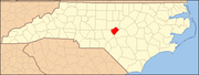 | |
| Town | ||
| Unincorporated communities |
| |
| Footnotes | ‡This populated place also has portions in an adjacent county or counties | |
| ||
Текст в блоке "Читать" взят с сайта "Википедия" и доступен по лицензии Creative Commons Attribution-ShareAlike; в отдельных случаях могут действовать дополнительные условия.
Другой контент может иметь иную лицензию. Перед использованием материалов сайта WikiSort.org внимательно изучите правила лицензирования конкретных элементов наполнения сайта.
Другой контент может иметь иную лицензию. Перед использованием материалов сайта WikiSort.org внимательно изучите правила лицензирования конкретных элементов наполнения сайта.
2019-2025
WikiSort.org - проект по пересортировке и дополнению контента Википедии
WikiSort.org - проект по пересортировке и дополнению контента Википедии