world.wikisort.org - USA
Croydon[1] is an unincorporated community in northeastern Morgan County, Utah, United States. It is part of the Ogden–Clearfield, Utah Metropolitan Statistical Area.
| Historical population | |||
|---|---|---|---|
| Census | Pop. | %± | |
| 1880 | 248 | — | |
| 1890 | 240 | −3.2% | |
| 1900 | 185 | −22.9% | |
| 1910 | 539 | 191.4% | |
| 1920 | 392 | −27.3% | |
| 1930 | 441 | 12.5% | |
| 1940 | 357 | −19.0% | |
| 1950 | 279 | −21.8% | |
| Source: U.S. Census Bureau[2] | |||
Croydon, Utah | |
|---|---|
Unincorporated community | |
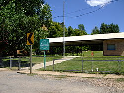 Croydon "City" Park, August 2008 | |
 Croydon Location of Croydon within the State of Utah  Croydon Croydon (the United States) | |
| Coordinates: 41°04′07″N 111°30′50″W | |
| Country | United States |
| State | Utah |
| County | Morgan |
| Settled | 1862 |
| Named for | Croydon |
| Elevation | 5,344 ft (1,629 m) |
| Time zone | UTC-7 (Mountain (MST)) |
| • Summer (DST) | UTC-6 (MDT) |
| ZIP codes | 84018 |
| Area code | 435 |
| GNIS feature ID | 1427128[1] |
Description
Accessible from Interstate 84, it is home to Holcim's Devil's Slide Cement Plant and several hundred residents. Lost Creek runs through this small unincorporated town, just northeast of the Devil's Slide rock formation. Cattle and sheep ranches can be found throughout the valley and in the surrounding mountains. Croydon was also home to the annual Widowmaker, hosted by the Wilde family of Croydon Utah, the Widowmaker was a snowmobile and motorcycle hillclimbing event for several years.
Croydon was originally called Lost Creek, and under the latter name was founded in 1862. The present name is after Croydon, in England, the native land of a large share of the first settlers.[3]
See also
![]() Utah portal
Utah portal
References
- "Croydon". Geographic Names Information System. United States Geological Survey, United States Department of the Interior.
- "Census of Population and Housing". United States Census Bureau. Archived from the original on 8 February 2006. Retrieved 4 Nov 2011.
- Van Cott, John W. (1990). Utah Place Names: A Comprehensive Guide to the Origins of Geographic Names: A Compilation. Salt Lake City: University of Utah Press. p. 97. ISBN 978-0-87480-345-7. OCLC 797284427. Retrieved 16 Feb 2018.
External links
 Media related to Croydon, Utah at Wikimedia Commons
Municipalities and communities of Morgan County, Utah, United States | ||
|---|---|---|
County seat: Morgan | ||
| City |  | |
| CDPs | ||
| Unincorporated communities |
| |
| ||
Authority control | |
|---|---|
| General |
|
| National libraries | |
This article about a location in Utah is a stub. You can help Wikipedia by expanding it. |
Другой контент может иметь иную лицензию. Перед использованием материалов сайта WikiSort.org внимательно изучите правила лицензирования конкретных элементов наполнения сайта.
WikiSort.org - проект по пересортировке и дополнению контента Википедии