world.wikisort.org - USA
Crawford is a ghost town in Galt and Odessa Townships in Rice County, Kansas, United States.[1] It lies along K-4 about 6 miles (9.7 km) east of Geneseo.[2]
Crawford, Kansas | |
|---|---|
Ghost town | |
 KDOT map of Rice County (legend) | |
 Crawford  Crawford | |
| Coordinates: 38°30′48″N 98°2′6″W[1] | |
| Country | United States |
| State | Kansas |
| County | Rice |
| Township | Galt |
| Elevation | 1,690 ft (520 m) |
| Population | |
| • Total | 0 |
| Time zone | UTC-6 (CST) |
| • Summer (DST) | UTC-5 (CDT) |
| Area code | 620 |
| FIPS code | 20-16275 [1] |
| GNIS ID | 484739 [1] |
History
For millennia, the land now known as Kansas was inhabited by Native Americans. In 1803, most of modern Kansas was secured by the United States as part of the Louisiana Purchase. In 1854, the Kansas Territory was organized, then in 1861 Kansas became the 34th U.S. state. In 1867, Rice County was founded.
Crawford had a post office from the 1880s until 1953.[3]
References
- "Crawford, Kansas", Geographic Names Information System, United States Geological Survey, United States Department of the Interior
- DeLorme. Kansas Atlas & Gazetteer. 4th ed. Yarmouth: DeLorme, 2009, p. 47. ISBN 0-89933-342-7.
- "Kansas Post Offices, 1828-1961". Kansas Historical Society. Archived from the original on October 9, 2013. Retrieved 22 June 2014.
Further reading
Municipalities and communities of Rice County, Kansas, United States | ||
|---|---|---|
County seat: Lyons | ||
| Cities | 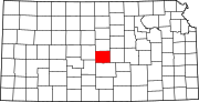 | |
| Unincorporated communities | ||
| Ghost towns | ||
| Townships |
| |
| ||
Текст в блоке "Читать" взят с сайта "Википедия" и доступен по лицензии Creative Commons Attribution-ShareAlike; в отдельных случаях могут действовать дополнительные условия.
Другой контент может иметь иную лицензию. Перед использованием материалов сайта WikiSort.org внимательно изучите правила лицензирования конкретных элементов наполнения сайта.
Другой контент может иметь иную лицензию. Перед использованием материалов сайта WikiSort.org внимательно изучите правила лицензирования конкретных элементов наполнения сайта.
2019-2026
WikiSort.org - проект по пересортировке и дополнению контента Википедии
WikiSort.org - проект по пересортировке и дополнению контента Википедии