world.wikisort.org - USA
Cranford is a census-designated place (CDP) comprising the downtown part of Cranford Township, Union County, New Jersey, United States. It was first listed as a CDP prior to the 2010 census.[3]
Cranford, New Jersey | |
|---|---|
Census-designated place | |
 Cranford  Cranford | |
| Coordinates: 40°39′23″N 74°18′13″W | |
| Country | United States |
| State | New Jersey |
| County | Union |
| Township | Cranford |
| Area | |
| • Total | 0.34 sq mi (0.88 km2) |
| • Land | 0.34 sq mi (0.87 km2) |
| • Water | 0.00 sq mi (0.01 km2) |
| Elevation | 82 ft (25 m) |
| Population (2020)[2] | |
| • Total | 2,032 |
| • Density | 6,029.67/sq mi (2,329.31/km2) |
| Time zone | UTC-5 (Eastern (EST)) |
| • Summer (DST) | UTC-4 (EDT) |
| ZIP Code | 07016 |
| Area code | 908 |
| FIPS code | 34-15638 |
| GNIS feature ID | 2389371[3] |
The CDP is bordered by Lincoln Avenue to the south and southwest, by the borough of Garwood to the west, by an unnamed stream and the Rahway River to the north and northeast, by Centennial Avenue to the east, and by Lincoln Park to the southeast.[4] New Jersey Route 28 (North Avenue) runs through the center of downtown, as does the NJ Transit Raritan Valley Line, with access at Cranford station. Elizabeth is 5 miles (8 km) to the east, and Plainfield is 6 miles (10 km) to the southwest.
Demographics
| Historical population | |||
|---|---|---|---|
| Census | Pop. | %± | |
| 2020 | 2,032 | — | |
| U.S. Decennial Census[5][2] | |||
References
- "ArcGIS REST Services Directory". United States Census Bureau. Retrieved October 11, 2022.
- "Census Population API". United States Census Bureau. Retrieved Oct 11, 2022.
- "Cranford Census Designated Place". Geographic Names Information System. United States Geological Survey, United States Department of the Interior.
- "Cranford CDP". TIGERweb. Geography Division, U.S. Census Bureau. Retrieved June 23, 2021.
- "Census of Population and Housing". Census.gov. Retrieved June 4, 2016.
Municipalities and communities of Union County, New Jersey, United States | ||
|---|---|---|
County seat: Elizabeth | ||
| Cities | 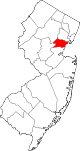 | |
| Boroughs | ||
| Town | ||
| Townships | ||
| CDPs |
| |
| Other communities |
| |
| ||
This Union County, New Jersey state location article is a stub. You can help Wikipedia by expanding it. |
Другой контент может иметь иную лицензию. Перед использованием материалов сайта WikiSort.org внимательно изучите правила лицензирования конкретных элементов наполнения сайта.
WikiSort.org - проект по пересортировке и дополнению контента Википедии