world.wikisort.org - USA
Copper Mountain is an unincorporated community and a census-designated place (CDP) located in and governed by Summit County, Colorado, United States. The CDP is a part of the Breckenridge, CO Micropolitan Statistical Area. The population of the Copper Mountain CDP was 385 at the United States Census 2010.[4] The Copper Mountain Consolidated Metropolitan District provides services. The Frisco post office (Zip Code 80443) serves the area.[3] The Copper Mountain CDP includes the Copper Mountain Ski Resort and Copper Mountain village.
Copper Mountain, Colorado | |
|---|---|
Census Designated Place | |
 Tucker Mountain at Copper Mountain Resort. | |
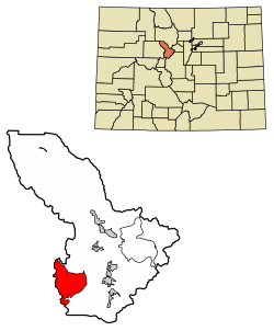 Location of the Copper Mountain CDP in Summit County, Colorado. | |
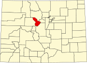
 Copper Mountain Location of the Copper Mountain CDP in the United States. | |
| Coordinates: 39°28′37″N 106°12′04″W[1] | |
| Country | |
| State | |
| County | Summit County |
| Government | |
| • Type | unincorporated community |
| Area | |
| • Total | 32.058 sq mi (83.030 km2) |
| • Land | 32.058 sq mi (83.030 km2) |
| • Water | 0.000 sq mi (0.000 km2) |
| Elevation | 11,368 ft (3,465 m) |
| Population (2020) | |
| • Total | 650 |
| • Density | 12/sq mi (5/km2) |
| Time zone | UTC-7 (MST) |
| • Summer (DST) | UTC-6 (MDT) |
| ZIP Code[3] | Frisco 80443 |
| Area code(s) | 970 |
| GNIS feature[2] | Copper Mountain CDP |
History
Copper Mountain was originally named "Wheeler" for a local judge and developer, and it has also been known as "Wheeler Station" in the past. The naming question was settled by a decision from the Board on Geographic Names, which ruled in favor of "Copper Mountain" in 1977.[2]
Geography
Copper Mountain is located approximately 20 miles (32 km) north-northeast of Leadville in the White River National Forest. Copper Mountain village has an elevation of 9,695 feet (2,955 m).
The Copper Mountain CDP has an area of 20,517 acres (83.030 km2), all land.[1]
Demographics
The United States Census Bureau initially defined the Copper Mountain CDP for the United States Census 2010.
| Year | Pop. | ±% |
|---|---|---|
| 2010 | 385 | — |
| 2020 | — | |
| Source: United States Census Bureau | ||
See also
- Outline of Colorado
- Index of Colorado-related articles
- State of Colorado
- Colorado cities and towns
- Colorado census designated places
- Colorado counties
- Colorado metropolitan areas
- Silverthorne, CO Micropolitan Statistical Area
- Colorado cities and towns
- White River National Forest
- Copper Mountain Ski Resort
References
- "State of Colorado Census Designated Places - BAS20 - Data as of January 1, 2020". United States Census Bureau. Retrieved December 27, 2020.
- "U.S. Board on Geographic Names: Domestic Names". United States Geological Survey. Retrieved December 27, 2020.
- "Zip Code 80443 Map and Profile". zipdatamaps.com. 2020. Retrieved December 27, 2020.
- "2010: DEC Summary File 1". United States Census Bureau. Retrieved December 27, 2020.
External links
 Definitions from Wiktionary
 Media from Commons
 News from Wikinews
 Quotations from Wikiquote
 Texts from Wikisource
 Textbooks from Wikibooks
 Resources from Wikiversity
- Copper Mountain @ Colorado.com
- Copper Mountain @ UncoverColorado.com
- Copper Mountain Consolidated Metropolitan District website
- Copper Mountain Resort Association website
- Copper Mountain Ski Resort website
- Summit County website
- White River National Forest website
Municipalities and communities of Summit County, Colorado, United States | ||
|---|---|---|
County seat: Breckenridge | ||
| Towns |
|  |
| CDPs |
| |
| Ghost towns |
| |
| ||
Authority control | |
|---|---|
| General |
|
| National libraries | |
Другой контент может иметь иную лицензию. Перед использованием материалов сайта WikiSort.org внимательно изучите правила лицензирования конкретных элементов наполнения сайта.
WikiSort.org - проект по пересортировке и дополнению контента Википедии