world.wikisort.org - USA
Cooperstown Township is one of nine townships in Brown County, Illinois, USA. As of the 2010 census, its population was 311 and it contained 162 housing units.[2]
Cooperstown Township | |
|---|---|
Township | |
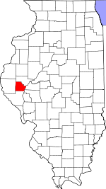
 Location in Brown County | |
 Brown County's location in Illinois | |
| Coordinates: 39°57′48″N 90°36′55″W | |
| Country | United States |
| State | Illinois |
| County | Brown |
| Established | November 8, 1853 |
| Area | |
| • Total | 41.45 sq mi (107.4 km2) |
| • Land | 40.67 sq mi (105.3 km2) |
| • Water | 0.78 sq mi (2.0 km2) 1.88% |
| Elevation | 627 ft (191 m) |
| Population (2010) | |
| • Estimate (2016)[1] | 303 |
| • Density | 7.6/sq mi (2.9/km2) |
| Time zone | UTC-6 (CST) |
| • Summer (DST) | UTC-5 (CDT) |
| ZIP codes | 62353, 62378 |
| FIPS code | 17-009-16262 |
Geography
According to the 2010 census, the township has a total area of 41.45 square miles (107.4 km2), of which 40.67 square miles (105.3 km2) (or 98.12%) is land and 0.78 square miles (2.0 km2) (or 1.88%) is water.[2]
Unincorporated towns
- Cooperstown
- La Grange
Cemeteries
The township contains these eleven cemeteries: Cooperstown, Cross Roads, De Witt, Elias Clark, Huffman, Hulett, Logan Creek, Logsdon Number 1, Logsdon Number 2, Perry and Tebo Burial Ground.
Major highways
 US Route 24
Lakes
- Big Lake
Demographics
| Historical population | |||
|---|---|---|---|
| Census | Pop. | %± | |
| 2016 (est.) | 303 | [1] | |
| U.S. Decennial Census[3] | |||
School districts
- Brown County Community Unit School District 1
Political districts
- Illinois' 18th congressional district
- State House District 93
- State Senate District 47
References
- "Cooperstown Township, Brown County, Illinois". Geographic Names Information System. United States Geological Survey. Retrieved 2010-01-04.
- United States Census Bureau 2007 TIGER/Line Shapefiles
- United States National Atlas
- "Population and Housing Unit Estimates". Retrieved June 9, 2017.
- "Population, Housing Units, Area, and Density: 2010 - County -- County Subdivision and Place -- 2010 Census Summary File 1". United States Census. Archived from the original on 2020-02-12. Retrieved 2013-05-28.
- "Census of Population and Housing". Census.gov. Retrieved June 4, 2016.
External links
Places adjacent to Cooperstown Township, Brown County, Illinois | ||||||||||||||||
|---|---|---|---|---|---|---|---|---|---|---|---|---|---|---|---|---|
| ||||||||||||||||
Municipalities and communities of Brown County, Illinois, United States | ||
|---|---|---|
County seat: Mount Sterling | ||
| Cities |  | |
| Villages |
| |
| Townships |
| |
| Unincorporated communities | ||
| Ghost towns |
| |
| ||
Текст в блоке "Читать" взят с сайта "Википедия" и доступен по лицензии Creative Commons Attribution-ShareAlike; в отдельных случаях могут действовать дополнительные условия.
Другой контент может иметь иную лицензию. Перед использованием материалов сайта WikiSort.org внимательно изучите правила лицензирования конкретных элементов наполнения сайта.
Другой контент может иметь иную лицензию. Перед использованием материалов сайта WikiSort.org внимательно изучите правила лицензирования конкретных элементов наполнения сайта.
2019-2025
WikiSort.org - проект по пересортировке и дополнению контента Википедии
WikiSort.org - проект по пересортировке и дополнению контента Википедии