world.wikisort.org - USA
Cookville is an unincorporated community in eastern Titus County, Texas, United States. It lies along U.S. Route 67 east of the city of Mount Pleasant, the county seat of Titus County.[1] Its elevation is 433 feet (132 m).[2] Although Cookville is unincorporated, it has a post office, with the ZIP code of 75558, located at the junction of US 67 and Farm to Market Road 1000.[3]
Cookville | |
|---|---|
Unincorporated community | |
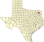
 Cookville Location within the state of Texas  Cookville Cookville (the United States) | |
| Coordinates: 33°11′8″N 94°51′16″W | |
| Country | United States |
| State | Texas |
| County | Titus |
| Elevation | 433 ft (132 m) |
| Time zone | UTC-6 (Central (CST)) |
| • Summer (DST) | UTC-5 (CDT) |
| ZIP codes | 75558 |
| GNIS feature ID | 1333275 |
References
- Rand McNally. The Road Atlas '08. Chicago: Rand McNally, 2008, p. 100.
- U.S. Geological Survey Geographic Names Information System: Cookville, Texas
- Zip Code Lookup Archived 2011-06-15 at the Wayback Machine
External links
Municipalities and communities of Titus County, Texas, United States | ||
|---|---|---|
County seat: Mount Pleasant | ||
| Cities |  | |
| Town | ||
| Unincorporated communities |
| |
| ||
 | This article about a location in Titus County, Texas is a stub. You can help Wikipedia by expanding it. |
Текст в блоке "Читать" взят с сайта "Википедия" и доступен по лицензии Creative Commons Attribution-ShareAlike; в отдельных случаях могут действовать дополнительные условия.
Другой контент может иметь иную лицензию. Перед использованием материалов сайта WikiSort.org внимательно изучите правила лицензирования конкретных элементов наполнения сайта.
Другой контент может иметь иную лицензию. Перед использованием материалов сайта WikiSort.org внимательно изучите правила лицензирования конкретных элементов наполнения сайта.
2019-2026
WikiSort.org - проект по пересортировке и дополнению контента Википедии
WikiSort.org - проект по пересортировке и дополнению контента Википедии